Skip to content

Chapter 9: India and the world on a map

World geography essentials

The world facts exams ask about most, from continents, peaks, rivers, deserts and lakes to the key straits and canals, tricky capitals, time zones and record-breaking countries.

In one minute

6 facts to know

  1. Asia is the largest continent and Australia the smallest. The Pacific is the largest ocean and the Arctic the smallest.
  2. Mount Everest, at 8,849 metres, is the highest peak on Earth. The Tibetan Plateau to its north is the highest plateau, the Roof of the World.
  3. The Nile is usually named the longest river; the Amazon carries the most water.
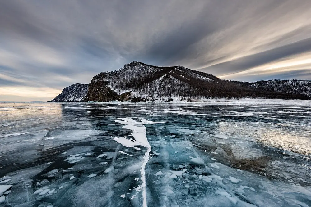
  4. Antarctica is the largest desert and the Sahara the largest hot desert. The Caspian Sea is the largest lake and Baikal the deepest.
  5. The Suez Canal (1869) joins the Mediterranean and the Red Sea; the Panama Canal (1914) joins the Atlantic and the Pacific.
  6. Russia is the largest country, Vatican City the smallest, and India the most populous since 2023. Indian Standard Time is UTC plus 5 hours 30 minutes.

Continents and oceans

About 71 percent of the Earth's surface is water. The land is usually split into seven continents.

Continent Rank by area Highest peak Height
Asia 1 (largest) Mount Everest, Nepal and China 8,849 m
Africa 2 Kilimanjaro, Tanzania 5,895 m
North America 3 Denali, Alaska (USA) 6,190 m
South America 4 Aconcagua, Argentina about 6,960 m
Antarctica 5 Vinson 4,892 m
Europe 6 Elbrus, Russia 5,642 m
Australia 7 (smallest) Kosciuszko 2,228 m

Two answers depend on where you draw the line:

  • Europe: Elbrus is in the Caucasus mountains. Lists that leave the Caucasus out of Europe give Mont Blanc in the Alps instead.
  • Australia: Kosciuszko is the highest point on the Australian mainland. Lists that use the wider region of Oceania give Puncak Jaya (4,884 m) on the island of New Guinea.
  • Denali was called Mount McKinley for most of the 20th century. The United States government brought the name Mount McKinley back in 2025, but Alaska and the national park around it still say Denali.

There are five oceans:

Ocean Rank by area Remember it for
Pacific 1 (largest) Also the deepest; the Mariana Trench is the deepest point on Earth
Atlantic 2 Between the Americas on one side and Europe and Africa on the other
Indian 3 Washes India's coasts: the Arabian Sea and the Bay of Bengal are parts of it
Southern 4 The ring of water around Antarctica, now counted as the fifth ocean
Arctic 5 (smallest) Also the shallowest, and much of it is frozen

Mountains and plateaus

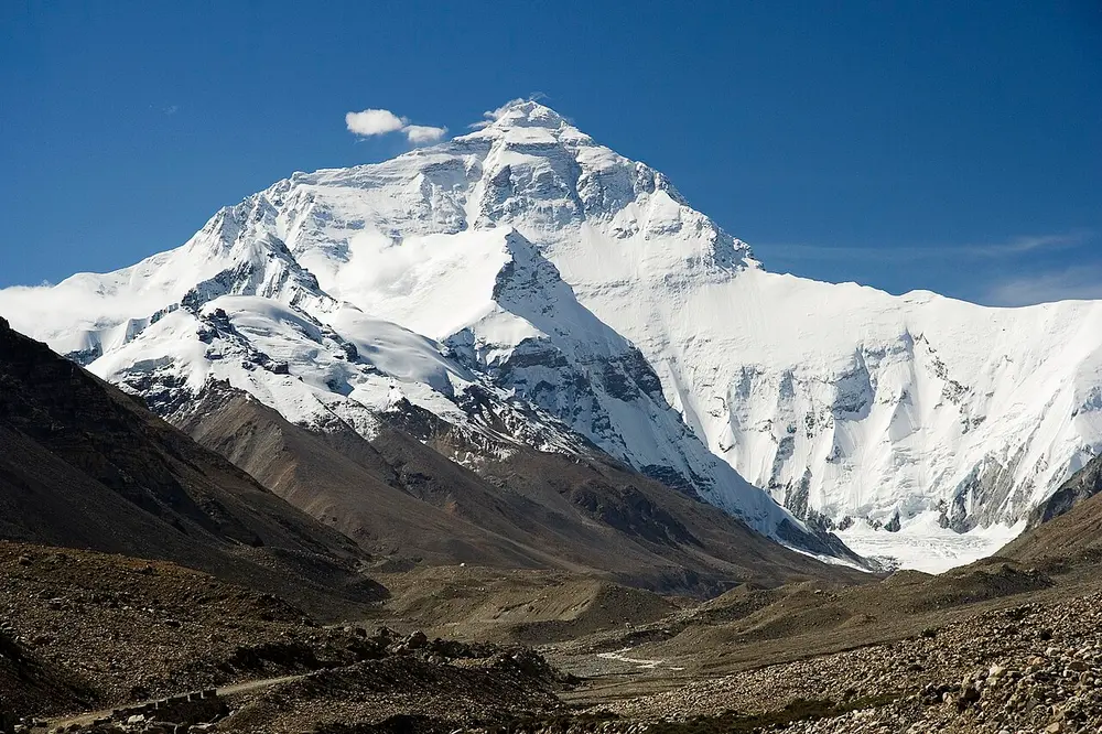
A huge snow-covered pyramid of a mountain under a deep blue sky, rising above a brown, rocky valley.
Picture: Luca Galuzzi (Lucag). CC BY-SA 2.5.

Mount Everest

Also called Sagarmatha in Nepal, Chomolungma in Tibet

Where
The Himalaya, on the border of Nepal and China (Tibet)
When
First climbed on 29 May 1953
Who
First climbed by Tenzing Norgay and Edmund Hillary

The highest point on Earth above sea level. Nepal and China measured it together and announced a height of 8,848.86 metres in December 2020. The British-run Survey of India named it after George Everest, a former head of the survey, in the 19th century.

Spot it by

The north face, seen from the Tibet side on the way to base camp (pictured).

Remember

Tenzing and Hillary, 29 May 1953. Bachendri Pal was the first Indian woman to reach the top, in 1984.

Don't confuse

K2, in the Karakoram range, is the second-highest peak. Kangchenjunga, on the border of Sikkim and Nepal, is the third.
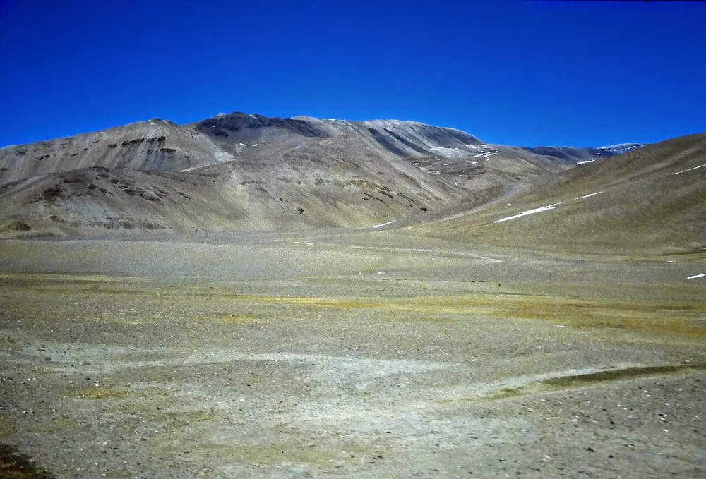
A wide, bare, gravelly plain at high altitude with rounded brown hills and patches of snow under a dark blue sky.
Picture: Jan Kranendonk (https://www.jankranendonk.nl). CC BY-SA 4.0.

Tibetan Plateau

Also called The Roof of the World

Where
North of the Himalaya, mostly in Tibet and Qinghai in China

A plateau is a wide, raised area of fairly flat land. This is the highest and largest one on Earth, with an average height of more than 4,500 metres. Several of Asia's great rivers begin here, including the Indus, the Brahmaputra (called the Yarlung Tsangpo in Tibet), the Yangtze and the Mekong.

Spot it by

Cold, dry, treeless high ground with low hills, between Nepal and Shigatse (pictured).

Remember

Highest plateau, Tibetan. Highest peak, Everest. They sit side by side.

Don't confuse

The Pamir mountains in Central Asia are also called the Roof of the World. The Deccan Plateau in India is far lower and older.

Rivers

River Continent Length, about Remember it for
Nile Africa 6,650 km Usually named the longest; flows north into the Mediterranean
Amazon South America 6,400 km Carries the most water of any river
Yangtze Asia 6,300 km The longest river in Asia; the Three Gorges Dam stands on it

The Nile or the Amazon? Measuring a river is harder than it sounds, because you have to agree on where its farthest source is and where it ends. Most textbooks and exam keys give the Nile about 6,650 km and the Amazon about 6,400 km. Some studies that traced a more distant source in Peru have made the Amazon the longer one, and other recent measurements make the Nile longer again. For an exam, the Nile is the longest and the Amazon is the largest by the amount of water it carries.

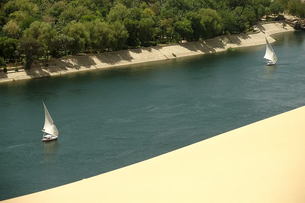
Two white-sailed wooden boats on a wide blue river, with a green bank of trees on the far side and pale desert sand in the foreground.
Picture: Vyacheslav Argenberg. CC BY 4.0.

Nile

Where
North-east Africa, flowing north through Sudan and Egypt to the Mediterranean Sea

It has two main branches. The White Nile starts near Lake Victoria and the Blue Nile starts at Lake Tana in Ethiopia; they meet at Khartoum, the capital of Sudan. Ancient Egypt grew up along its banks, because the river's floods left rich soil in the middle of a desert.

Spot it by

A strip of green along the water, with desert right up to the edge (pictured at Aswan, with sailing boats called feluccas).

Remember

The Nile flows north, which surprises people.
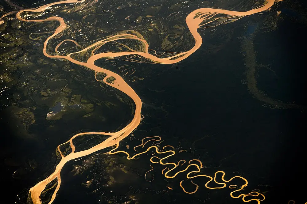
A photo from space of a wide, golden-brown river looping through dark green forest, with smaller rivers curling beside it.
Picture: Alexander Gerst. CC BY-SA 2.0.

Amazon

Where
South America; rises in the Andes of Peru and flows east across Brazil to the Atlantic

The largest river in the world by the amount of water it carries: about a fifth of all the river water that flows into the oceans. Its basin holds the largest tropical rainforest on Earth.

Spot it by

A wide, muddy river winding through unbroken forest, photographed from the International Space Station in 2018 (pictured).

Remember

Nile for length, Amazon for volume.

Deserts and lakes

A desert is any place that gets very little rain or snow, usually less than about 250 mm a year. It doesn't have to be hot or sandy, which is why the largest desert is a frozen one.

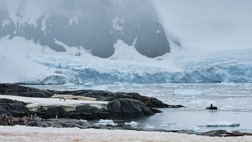
A wall of blue-white glacier ice below dark, misty mountains, with rocks, floating ice and a few penguins in the foreground.
Picture: Pedro Szekely from Los Angeles, USA. CC BY-SA 2.0.

Antarctica

Where
Around the South Pole

The largest desert on Earth, about 14 million square km, because very little new snow falls on most of it each year. It is also the coldest and windiest continent. No country owns it: the Antarctic Treaty of 1959 keeps it for peace and science, and India runs two research stations there, Maitri and Bharati.

Spot it by

Glaciers meeting the sea, with penguins on the rocks (pictured).

Remember

Largest desert, Antarctica. Largest hot desert, Sahara.
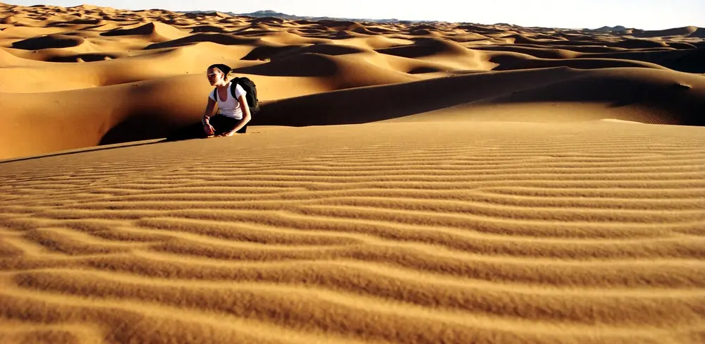
Rows of golden sand dunes with fine ripples in the sand, and a person in a white T-shirt sitting on a dune.
Picture: Dr. Ondřej Havelka (cestovatel). CC BY 4.0.

Sahara

Where
Across North Africa, from the Atlantic coast to the Red Sea

The largest hot desert in the world, about 9 million square km, nearly the size of China or the United States. Only part of it is sand dunes; much of it is bare rock and gravel.

Spot it by

Rippled sand dunes near the border of Algeria and Morocco (pictured).

Don't confuse

The Atacama in Chile is the driest hot desert, not the largest. The Thar in Rajasthan is India's great desert.
Lake record Lake Where
Largest lake of all Caspian Sea Between Europe and Asia
Deepest, and most fresh water Baikal Siberia, Russia
Largest freshwater lake by area Lake Superior North America (USA and Canada)
Largest lake in Africa Lake Victoria Uganda, Kenya and Tanzania
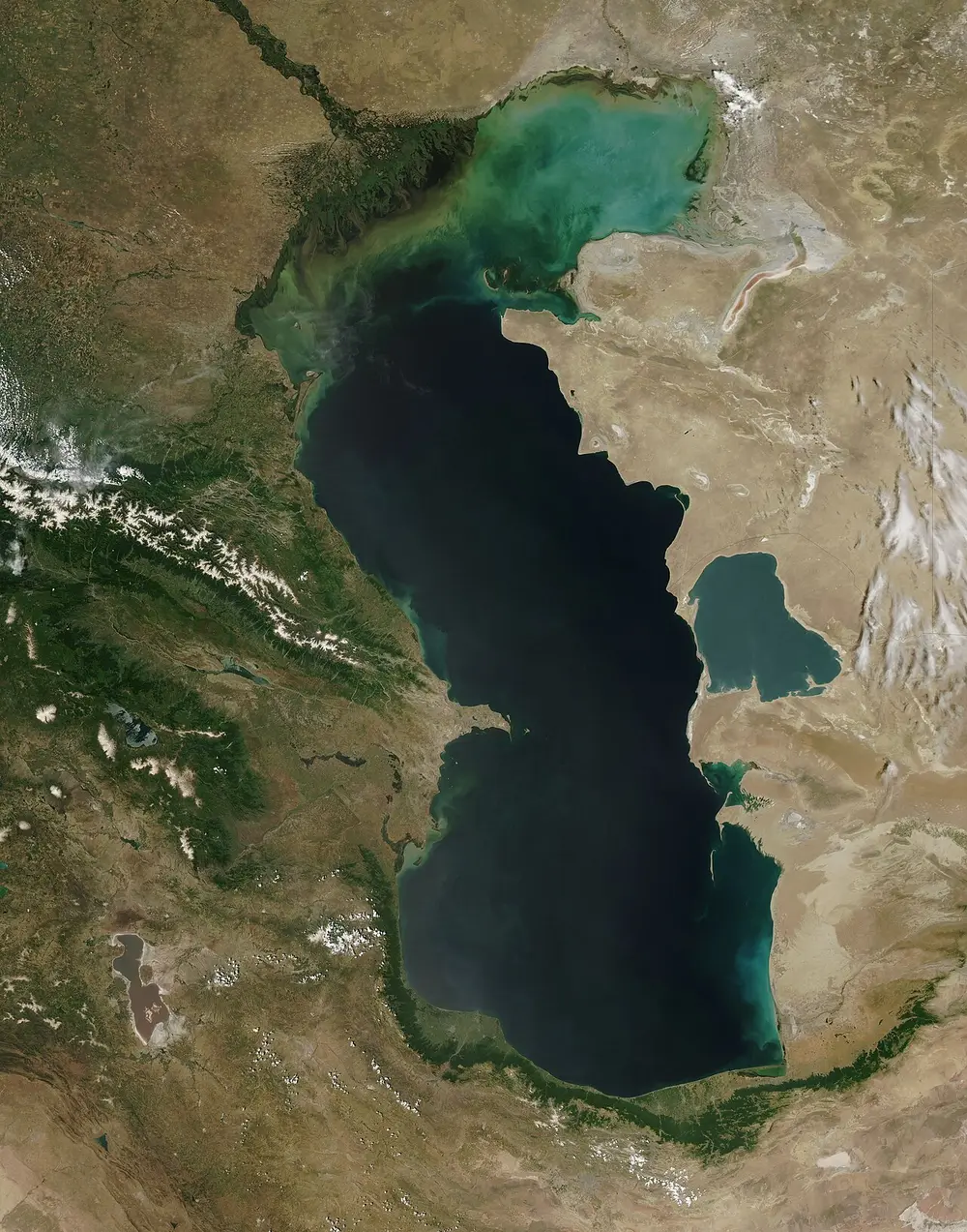
A satellite photo of a large, dark, roughly S-shaped body of water surrounded by brown and green land, with snowy mountains on the left.
Picture: Caspian_Sea_from_orbit.jpg: Jeff Schmaltz, MODIS Rapid Response Team, NASA/GSFC derivative work: IdLoveOne (talk). Public domain.

Caspian Sea

Where
Between Europe and Asia; its shores belong to Russia, Kazakhstan, Turkmenistan, Iran and Azerbaijan

The largest lake in the world, about 371,000 square km, roughly the size of Japan. It's called a sea because it is big and its water is slightly salty, about a third as salty as the ocean. It has no outlet to the ocean.

Spot it by

Seen from a satellite (pictured), with the Caucasus mountains in snow on the left.

Remember

Caspian is the largest lake even though its name says sea.
A frozen lake with clear, cracked blue ice in the foreground and a dark forested hill beyond, under streaky grey clouds.
Picture: Sergey Pesterev. CC BY-SA 4.0.

Lake Baikal

Where
Southern Siberia, Russia

The deepest lake in the world, about 1,642 metres at its deepest, and also the oldest, at 25 to 30 million years. Because it is so deep, it holds more fresh water than any other lake: more than all five North American Great Lakes together.

Spot it by

Thick, glass-clear ice in winter, near Olkhon Island (pictured).

Remember

Baikal is the deepest; Caspian is the largest.

Straits and canals

A strait is a narrow stretch of sea between two pieces of land that joins two larger seas. A canal is a waterway dug by people. Both save ships thousands of kilometres.

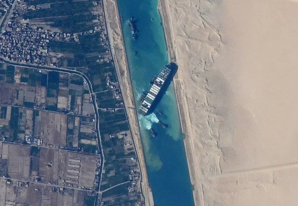
A photo from space of a straight canal through the desert, with a long container ship stuck diagonally across it.
Picture: NASA JSC ISS image library. Public domain.

Suez Canal

Where
Egypt, joining the Mediterranean Sea and the Red Sea
When
Opened on 17 November 1869
Who
Built by a French company led by Ferdinand de Lesseps

A canal about 193 km long, at sea level, so it needs no locks. It lets ships sail between Europe and Asia without going all the way round Africa. Egypt's president Gamal Abdel Nasser took control of it in 1956, which led to the Suez Crisis.

Spot it by

In March 2021 the container ship Ever Given got stuck across the canal for six days and held up world trade (pictured from the International Space Station).

Remember

Suez is older (1869); Panama came later (1914).
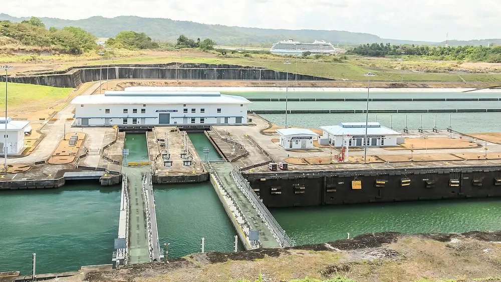
A set of huge concrete canal locks with water channels, gates and small control buildings, and a cruise ship in the distance.
Picture: Dr. Thomas Liptak. CC BY-SA 4.0.

Panama Canal

Where
Panama, in Central America, joining the Atlantic (through the Caribbean Sea) and the Pacific
When
Opened on 15 August 1914; a wider set of locks opened in 2016
Who
Built by the United States after a French attempt failed; handed over to Panama at the end of 1999

A canal about 82 km long across the narrowest part of the Americas. Unlike Suez, it uses locks: chambers that fill with water to lift ships about 26 metres up to a man-made lake in the middle, then lower them on the other side.

Spot it by

Giant lock chambers with gates (pictured, the Agua Clara locks of 2016).

Remember

Panama joins two oceans; Suez joins two seas.
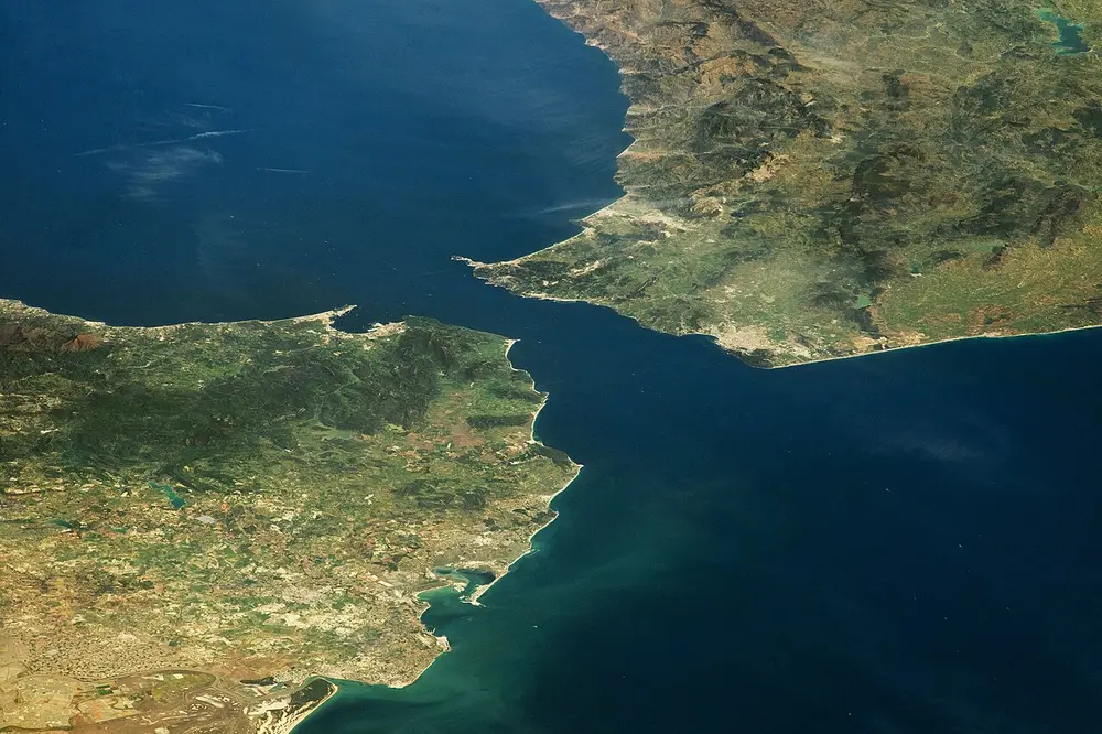
A photo from space of two green and brown coastlines almost touching across a narrow channel of dark blue sea.
Picture: NASA/NASA Earth Observatory. Public domain.

Strait of Gibraltar

Where
Between Spain in Europe and Morocco in Africa

The narrow gateway between the Atlantic Ocean and the Mediterranean Sea, only about 13 to 14 km wide at its narrowest. The ancient Greeks called the rocks on either side the Pillars of Hercules.

Spot it by

Europe and Africa almost meeting, photographed from space in April 2023 (pictured).

Remember

Gibraltar is the Mediterranean's door to the Atlantic.
Strait Between Joins
Malacca The Malay Peninsula and Sumatra (Indonesia) The Andaman Sea and the South China Sea, so the Indian and Pacific Oceans
Hormuz Iran and Oman The Persian Gulf and the Gulf of Oman; a key route for oil tankers
Gibraltar Spain and Morocco The Atlantic Ocean and the Mediterranean Sea
Palk Tamil Nadu (India) and northern Sri Lanka The Bay of Bengal and Palk Bay
Bering Russia and Alaska (USA) The Arctic and Pacific Oceans
Bosphorus Europe and Asia, through Istanbul The Black Sea and the Sea of Marmara
  1. 1869

    The Suez Canal opens, joining the Mediterranean and the Red Sea

  2. 1914

    The Panama Canal opens, joining the Atlantic and the Pacific

  3. 1956

    Egypt takes over the Suez Canal, leading to the Suez Crisis

  4. 1999

    The United States hands the Panama Canal to Panama

  5. 2016

    Panama's wider new locks open

  6. 2021

    The Ever Given blocks the Suez Canal for six days

Capitals that trip people up

In many countries the capital isn't the biggest or best-known city. Some capitals were built from scratch, and a few countries have more than one.

Country Capital Why it's tricky
Australia Canberra Not Sydney or Melbourne; a planned city built as a compromise between the two
Canada Ottawa Not Toronto or Montreal; chosen by Queen Victoria in 1857
Brazil Brasília Not Rio de Janeiro; the capital since 1960
South Africa Pretoria, Cape Town and Bloemfontein Three capitals: Pretoria for the government, Cape Town for Parliament, Bloemfontein for the courts
Myanmar Nay Pyi Taw Not Yangon; the government moved to this new city in 2005 and 2006
Turkey Ankara Not Istanbul
United States Washington, DC Not New York
Switzerland Bern Not Zurich or Geneva
New Zealand Wellington Not Auckland
Nigeria Abuja Not Lagos; the capital since 1991
Pakistan Islamabad Not Karachi; a planned city built in the 1960s
Sri Lanka Sri Jayawardenepura Kotte Parliament sits here; Colombo, next door, is the business capital
Kazakhstan Astana Not Almaty; it was renamed Nur-Sultan in 2019 and went back to Astana in 2022
Somalia Mogadishu A port city on the Indian Ocean coast
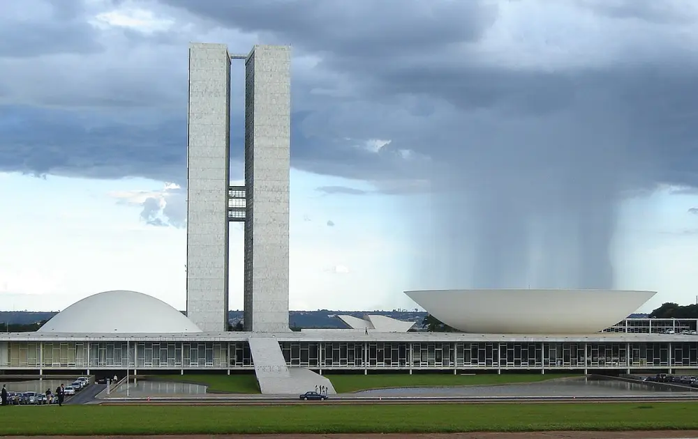
A modernist government complex with two tall slim towers, a white dome on one side and a white upturned bowl on the other, under dark rain clouds.
Picture: Eurico Zimbres. CC BY-SA 2.5.

Brasília

Where
Central Brazil, on a high plateau far from the coast
When
Inaugurated on 21 April 1960
Who
City plan by Lúcio Costa; main buildings by the architect Oscar Niemeyer; built under President Juscelino Kubitschek
Style
Modernist planned capital

Brazil moved its capital from Rio de Janeiro to a brand-new city built in about four years, to draw people and money inland. Costa's plan is often compared to an aeroplane or a bird, with government buildings along the body and homes in the wings. It became a World Heritage Site in 1987.

Spot it by

The National Congress (pictured): twin office towers between a dome for the Senate and an upturned bowl for the Chamber of Deputies.

Remember

Brasília is Brazil's Chandigarh: a modernist city planned from scratch around the same time, by an architect with a strong personal style.

Don't confuse

Canberra is also a planned capital, designed by the American architects Walter Burley Griffin and Marion Mahony Griffin after a design competition in 1912.

Lines on the globe and time

Latitude lines run east to west and tell you how far north or south a place is. Longitude lines run from pole to pole and tell you how far east or west.

Line Where Why it matters
Equator 0 degrees latitude Splits the Earth into northern and southern halves
Tropic of Cancer About 23.5 degrees north The sun is straight overhead at noon here around 21 June
Tropic of Capricorn About 23.5 degrees south The sun is straight overhead here around 22 December
Prime Meridian 0 degrees longitude, through Greenwich in London World time is counted from here
International Date Line Roughly 180 degrees, in the Pacific Crossing it changes the date by one day
India's standard meridian 82.5 degrees east, near Mirzapur in Uttar Pradesh Sets Indian Standard Time

The Tropic of Cancer in India crosses eight states. From west to east: Gujarat, Rajasthan, Madhya Pradesh, Chhattisgarh, Jharkhand, West Bengal, Tripura and Mizoram. It cuts the country into two roughly equal halves.

How time zones work. The Earth turns a full circle, 360 degrees, in 24 hours. So every 15 degrees of longitude is one hour, and every degree is four minutes. Places to the east see the sun first, so their clocks are ahead.

  • UTC (Coordinated Universal Time) is the world's reference clock, kept at the Prime Meridian. It replaced the older name GMT, Greenwich Mean Time.
  • IST (Indian Standard Time) is set by the 82.5 degrees east line. 82.5 divided by 15 is 5.5, so IST is UTC plus 5 hours 30 minutes. When it is noon in London in winter, it is 5:30 pm in India. India uses this one time zone across the whole country.
  • The International Date Line zigzags around island nations so that no country is split between two dates. Cross it going west (from America towards Asia) and the date jumps forward a day; cross it going east and you go back a day.
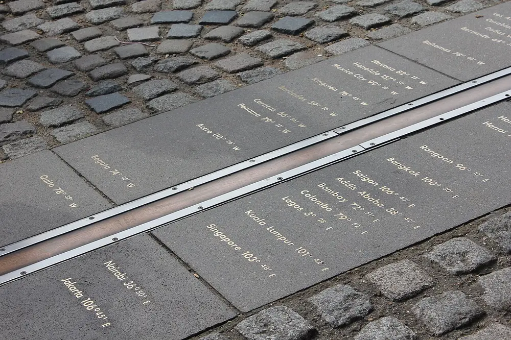
A metal strip set into paving stones, with the names of world cities and their longitudes written on either side.
Picture: Perituss. CC0.

Royal Observatory, Greenwich

Also called The Prime Meridian

Where
Greenwich, London, England
When
The observatory was founded in 1675; its line was chosen as 0 degrees longitude in 1884

At a conference in Washington, DC in 1884, countries agreed to count longitude, and so world time, from the line through this observatory. Every other place is so many degrees east or west of it.

Spot it by

The metal line in the courtyard (pictured), with cities such as Bombay and Colombo marked on the eastern side. Visitors stand with one foot in each half of the world.

Remember

Greenwich is 0 degrees; India's clock line is 82.5 degrees east.

Record-breaking countries

Record Country Remember it for
Largest by area Russia About 17 million square km across 11 time zones; Canada is second
Smallest by area Vatican City Less than half a square km, inside the city of Rome; Monaco is second smallest
Most people India Passed China in April 2023, according to the United Nations
India by area Seventh largest After Russia, Canada, China, the United States, Brazil and Australia
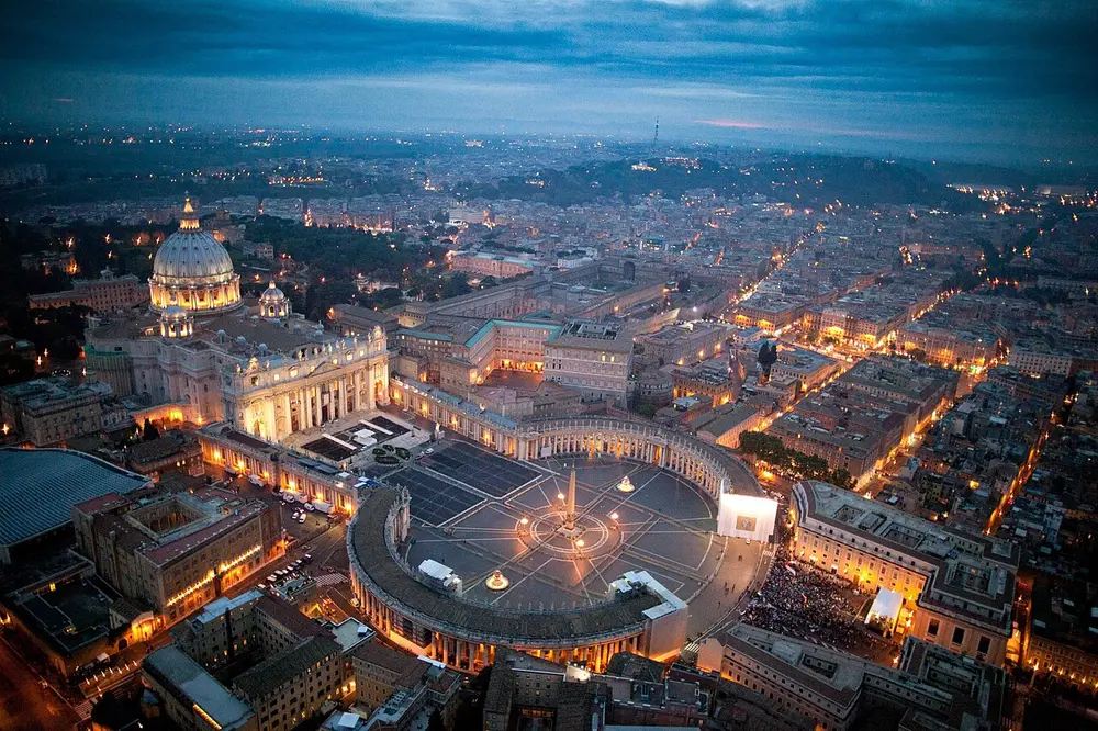
An aerial view at dusk of a huge domed church facing a vast oval square ringed by curved rows of columns, with city lights all around.
Picture: lafiguradelpadre Congreso. CC BY 2.0.

Vatican City

Where
Inside Rome, Italy
When
An independent state since the Lateran Treaty of 1929
Who
Ruled by the Pope, the head of the Catholic Church

The smallest country in the world, both by area (less than half a square km) and by number of people (under a thousand). Much of it is taken up by St Peter's Basilica, its square and the Vatican gardens and museums. The Sistine Chapel, with Michelangelo's ceiling, is here.

Spot it by

St Peter's dome and the oval square with its curved colonnades (pictured).

Remember

Smallest, Vatican City. Largest, Russia. Most people, India.

Exams also ask about the nicknames of countries:

Country Nickname Why
Japan Land of the Rising Sun Its own name, Nihon, means where the sun comes from
Finland Land of a Thousand Lakes It has far more than a thousand lakes
Norway Land of the Midnight Sun In the far north, the summer sun never sets
Bhutan Land of the Thunder Dragon Its own name for itself, Druk Yul

Test yourself

Question 1 of 8

This canal, with a container ship stuck across it in 2021, joins which two seas?

Question 2 of 8

This building stands in a capital city planned from scratch and opened in 1960. Which city?

Question 3 of 8

The metal line in this courtyard marks 0 degrees longitude. Where is it?

Question 4 of 8

Which river, seen here from space, carries more water than any other?

Question 5 of 8

Which is the highest plateau in the world?

Question 6 of 8

It is 12 noon UTC. What time is it in India?

Question 7 of 8

What is the capital of Australia?

Question 8 of 8

Which is the largest desert in the world?

From past papers

Real exam questions on this topic, each with a full solution.

Finished this note?

Mark it as studied to track your progress through the course.

Was this note useful?

Each picture is credited underneath it. Pictures of works still in copyright are shown small, for teaching only. If you hold the rights to a picture and want it removed, tell us through the contact page and we will take it down.