Skip to content

Chapter 10: Environment, climate and sustainable design

How cities are planned and grow

From the grid streets and drains of Mohenjo-daro to Jaipur, Chandigarh, Brasília and the Smart Cities Mission, with the planners, problems and ideas that shape cities.

In one minute

6 facts to know

  1. Mohenjo-daro (about 2500 BCE) had grid streets, baked-brick houses, covered drains and the Great Bath. Dholavira in Kutch is famous for storing water in a dry land.
  2. Jaipur was founded in 1727 by Sawai Jai Singh II and planned by Vidyadhar Bhattacharya on a grid of nine squares.
  3. New Delhi was planned by Edwin Lutyens and Herbert Baker and opened in 1931; Chandigarh, by Le Corbusier, is made of rectangular sectors.
  4. Brasília (Lúcio Costa and Oscar Niemeyer, 1960) is shaped like an aeroplane; Canberra was planned by Walter Burley Griffin and Marion Mahony Griffin.
  5. Ebenezer Howard's Garden City (1898) mixed town and country; Jane Jacobs (1961) defended busy, mixed streets; Patrick Geddes surveyed Indian towns before changing them.
  6. India's first metro opened in Kolkata in 1984; Ahmedabad's Janmarg BRTS opened in 2009; the Smart Cities Mission and AMRUT began in 2015.

The first planned cities

About 4,500 years ago, the Harappan or Indus Valley Civilisation built some of the world's first planned cities, in what is now Pakistan and northwest India. Their streets ran in straight lines, their bricks were made to standard sizes, and their drains were better than those of many cities thousands of years later. Unlike Egypt or Mesopotamia, they left no clear palaces or giant royal tombs, so we still don't know who ruled them.

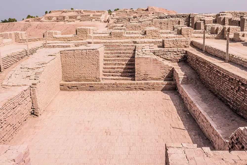
The ruins of a large rectangular brick tank with steps leading down into it at one end, surrounded by low brick walls of rooms.
Picture: Soban. CC BY-SA 3.0.

Mohenjo-daro

Where
Larkana district, Sindh, Pakistan
When
Built about 2500 BCE
Who
The Harappan (Indus Valley) Civilisation
Made with
Mainly fired brick

Mohenjo-daro was one of the largest Harappan cities. It had two parts: a raised citadel on a high mound and a larger lower town where most people lived. Streets crossed at right angles in a grid, and houses had bathrooms whose waste water ran into covered brick drains along the streets. On the citadel stands the Great Bath (pictured), about 12 metres long, 7 metres wide and 2.4 metres deep, made watertight with tightly fitted bricks and a layer of bitumen (natural tar). It was probably used for ritual bathing. Mohenjo-daro has been a World Heritage Site since 1980.

Spot it by

Neat brick walls in straight lines, and a sunken brick tank with steps at each end.

Remember

Mohenjo-daro: grid, drains and the Great Bath.

Don't confuse

Harappa, the first Indus city to be dug, is in Punjab, Pakistan; Mohenjo-daro is in Sindh. Dholavira and Lothal are Harappan cities in Gujarat, India.
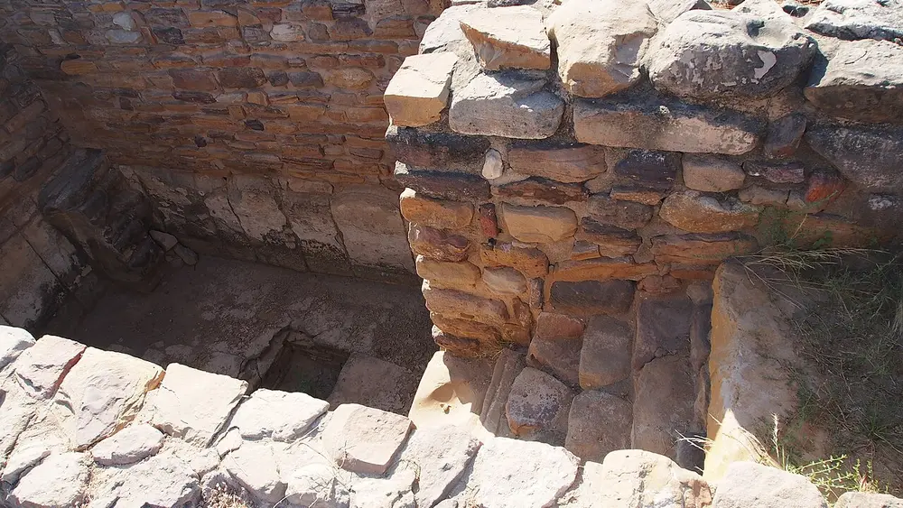
A deep rectangular tank built of rough stone blocks, with stone steps leading down into it, at an ancient ruined site.
Picture: Prof Ranga Sai. CC BY-SA 4.0.

Dholavira

Where
Khadir Bet island, Rann of Kutch, Gujarat
When
About 3000 to 1500 BCE
Who
The Harappan Civilisation
Made with
Stone and mud brick

Dholavira stands on an island in the salt desert of Kutch, where rain is scarce. Its builders caught the water of two seasonal streams, the Mansar and the Manhar, with dams and channels, and stored it in large stone reservoirs (pictured) inside the city walls. Unlike Mohenjo-daro, the city was laid out in three parts from the start: a citadel, a middle town and a lower town. A large signboard of ten Harappan signs was also found near its northern gate. It became a World Heritage Site in 2021.

Spot it by

Stone-lined tanks and channels, built of stone rather than brick.

Remember

Dholavira saved every drop.

Planned cities of India

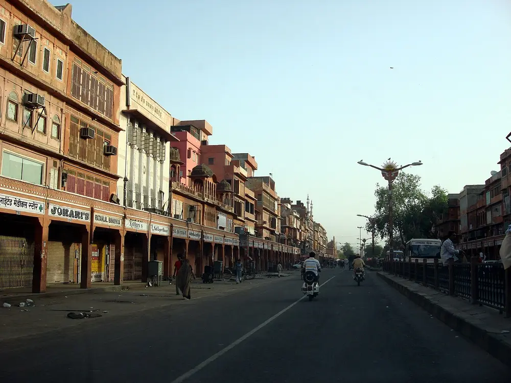
A wide, straight road in old Jaipur lined on both sides by matching pink-red buildings with shops below and balconies above.
Picture: Jorge Láscar from Australia. CC BY 2.0.

Jaipur

Where
Rajasthan
When
Founded in 1727
Who
Founded by Sawai Jai Singh II; planned by Vidyadhar Bhattacharya

Jai Singh II moved his capital down from the hill fort of Amer to the plain, partly because Amer was crowded and short of water. His planner, Vidyadhar Bhattacharya, a Bengali scholar, followed the old Indian building texts (the Vastu and Shilpa Shastras). He laid the city out as a grid of nine squares, three by three. A hill blocked one corner, so that square was moved to the east, and two central squares were joined for the City Palace. Wide straight main streets divide the squares, with matching shopfronts along them and large public squares, called chaupars, where they cross. The walled city has been a World Heritage Site since 2019.

Spot it by

Wide, straight bazaar streets with matching pink fronts and a grid of blocks.

Remember

Jaipur 1727: Jai Singh's city, Vidyadhar's grid.

Don't confuse

The pink colour came much later, in 1876; see the city nicknames note.
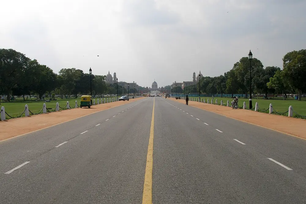
A long, straight, wide road with lawns and trees on both sides, leading to large domed government buildings in the far distance.
Picture: Vyacheslav Argenberg. CC BY 4.0.

New Delhi

Also called Lutyens' Delhi

Where
Delhi
When
Announced 1911; opened in 1931
Who
Edwin Lutyens and Herbert Baker, British architects

At the Delhi Durbar of 1911, King George V announced that the capital of British India would move from Calcutta to Delhi. A new city was built south of the old one and opened on 13 February 1931. Its heart is a grand straight avenue, once Kingsway, then Rajpath, and renamed Kartavya Path in 2022 (pictured). It runs from the Viceroy's House on Raisina Hill, now Rashtrapati Bhavan, past India Gate. Around it lie wide tree-lined roads meeting at roundabouts, with large bungalows in big gardens.

Spot it by

A long ceremonial axis, wide tree-lined avenues and roundabouts.

Remember

1911 announced, 1931 opened: Lutyens and Baker.
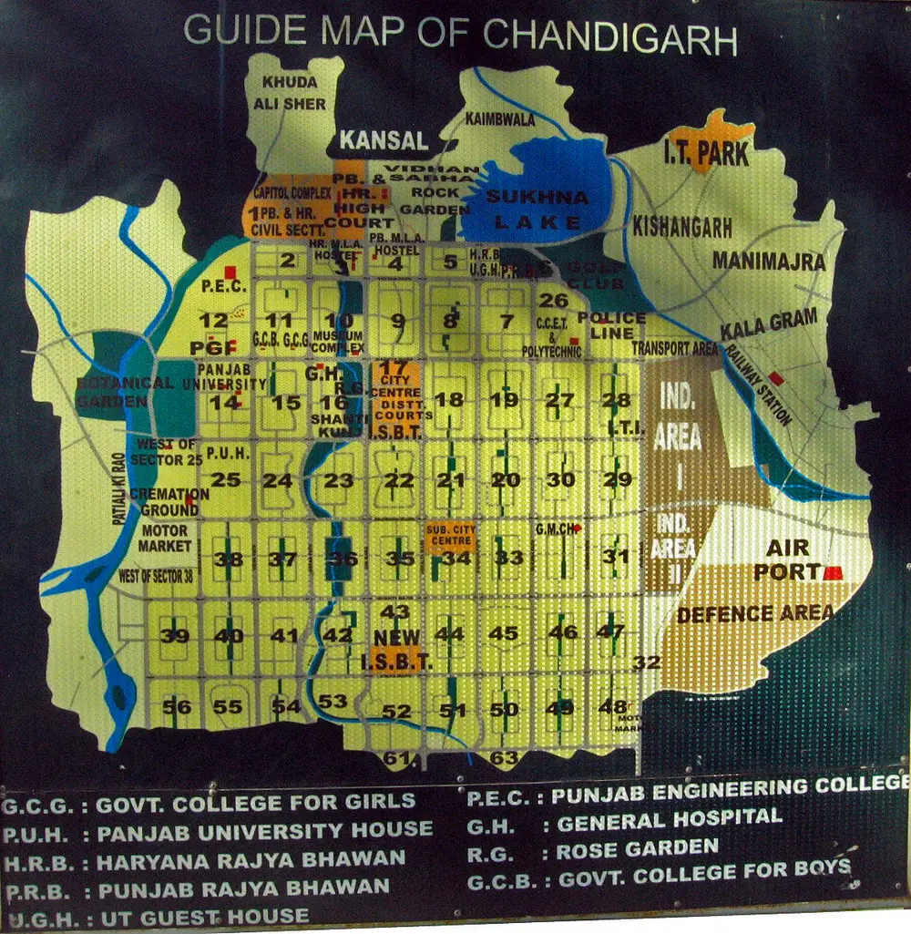
A city guide map of Chandigarh on a board, showing the city as a grid of numbered rectangular sectors, with Sukhna Lake at the top and the airport and industrial area at the edges.
Picture: Ajay Tallam. CC BY-SA 2.0.

Chandigarh

Where
Capital of both Punjab and Haryana
When
Planned from 1950; built in the 1950s and 1960s
Who
Le Corbusier, after a first plan by Albert Mayer and Matthew Nowicki

After Partition in 1947, Punjab lost its capital, Lahore, so India built a new one. Le Corbusier divided the city into sectors, rectangles of about 800 metres by 1,200 metres. Each sector was meant to be a small neighbourhood with its own shops, school and green space, so that daily needs were within about a ten-minute walk, while fast roads run between the sectors. Sector 17 is the city centre, and there is no Sector 13, which was left out as unlucky. Its Capitol Complex is a World Heritage Site; the modern Indian architecture note covers the buildings.

Spot it by

A city of numbered rectangular sectors, wide roads, roundabouts and greenery.

Remember

Chandigarh: a city of sectors, and no number 13.
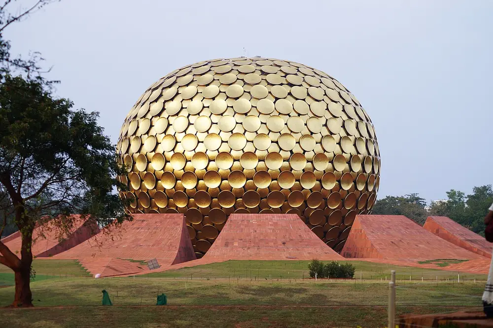
A huge golden globe made of round gold discs, rising out of a ring of curved red earth mounds on a green lawn.
Picture: Kpsudeep. CC BY-SA 4.0.

Auroville

Where
Near Puducherry, Tamil Nadu
When
Founded on 28 February 1968
Who
Founded by Mirra Alfassa, "the Mother"; designed by the French architect Roger Anger

Auroville was started as an experimental "universal township" where people from every country could live together. At its opening ceremony, delegates from 124 nations attended. Roger Anger's Galaxy plan places the Matrimandir (pictured), a golden meditation building, at the centre, with zones curving out from it like the arms of a spiral galaxy. The town has also become a testing ground for building with earth and for green technology.

Spot it by

A golden globe, the Matrimandir, at the centre of a round plan.

Remember

Auroville 1968: a galaxy around a golden globe.

More planned cities of India

City Planned Planner or developer Why it was built
Bhubaneswar 1946; capital from 1948 Otto Koenigsberger, German architect A new capital for Odisha, as Cuttack was flood-prone and crowded
Gandhinagar 1960s H.K. Mewada and Prakash Apte, who had worked on Chandigarh A new capital for Gujarat, formed in 1960
Navi Mumbai From 1971 CIDCO, with planners including Charles Correa A twin city across the harbour to take pressure off Mumbai
Dholera Since 2011 Government of Gujarat A new "smart city" on the Delhi to Mumbai industrial corridor

Planned cities of the world

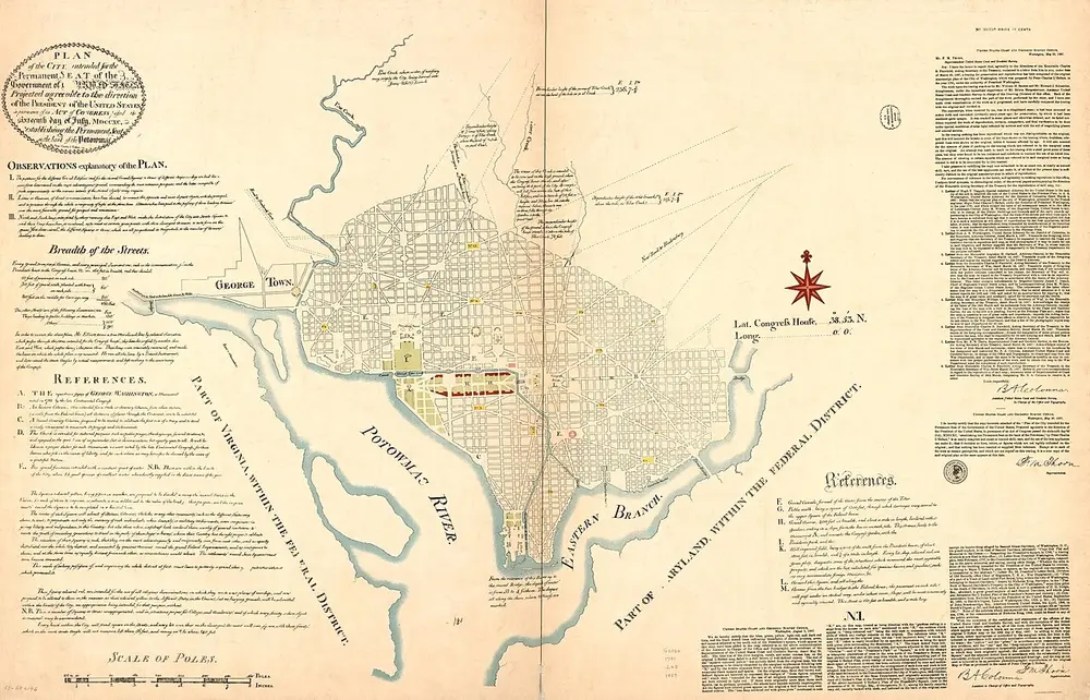
An old map of a city plan between two rivers, with a grid of streets crossed by long diagonal avenues, and blocks of handwritten notes on both sides.
Picture: Peter Charles L'Enfant. Public domain.

Washington, D.C.

Also called The L'Enfant Plan

Where
United States
When
1791
Who
Pierre Charles L'Enfant, French-born engineer

George Washington asked L'Enfant to plan the new capital of the United States. He drew a grid of streets and laid wide diagonal avenues across it, linking important places such as the Capitol and the President's House, with open squares where the avenues meet. A long open green, now the National Mall, runs from the Capitol. His plan later inspired New Delhi, Canberra and Brasília.

Spot it by

A grid with diagonal avenues cutting across it like spokes.

Remember

L'Enfant laid diagonals over a grid.
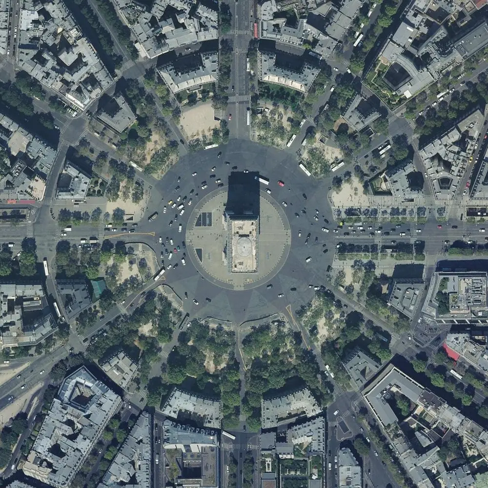
An aerial photo of a huge round junction with a monument in the middle, from which twelve straight avenues spread out like the points of a star between blocks of buildings.
Picture: Institut national de l'information géographique et forestière. Licence Ouverte.

Haussmann's Paris

Where
Paris, France
When
1853 to 1870
Who
Georges-Eugène Haussmann, for Emperor Napoleon III

In the 1850s Paris was a maze of narrow, dirty medieval lanes. Napoleon III put Haussmann in charge of rebuilding it. He cut long, wide, straight boulevards through old neighbourhoods, lined them with apartment blocks of matching height and style, and added parks, fountains and a huge new system of sewers. At the Place de l'Étoile ("square of the star", pictured), twelve avenues meet around the Arc de Triomphe. Many people lost their homes to the works, and Haussmann was dismissed in 1870.

Spot it by

Long straight boulevards, star-shaped junctions and rows of cream apartment blocks.

Remember

Haussmann gave Paris its boulevards.
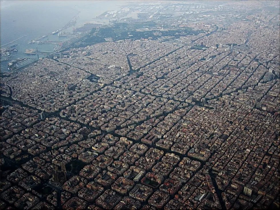
An aerial view of a huge city laid out in a perfectly regular grid of square blocks, stretching to the sea.
Picture: Alhzeiia. CC BY-SA 2.0.

The Eixample, Barcelona

Where
Barcelona, Spain
When
Plan of 1860
Who
Ildefons Cerdà, civil engineer

When Barcelona pulled down its old city walls, Cerdà planned the extension, the Eixample ("enlargement" in Catalan). It is a vast grid of identical square blocks whose corners are cut off, so every crossing opens into a small eight-sided square with more light, air and room to turn. Cerdà wanted gardens inside each block and markets, schools and hospitals spread evenly; later builders filled in most of the gardens. He also wrote one of the first books on city planning (1867), and gave the Spanish language its word for it, urbanización.

Spot it by

A regular grid of square blocks with cut-off corners.

Remember

Cerdà cut the corners.
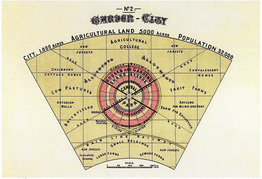
An old printed diagram of a wedge of a round city, with a central park, rings of houses and gardens, a railway around the edge and farmland, forests and farms outside.
Picture: Ebenezer Howard. Public domain.

The Garden City

Where
England
When
Book published 1898; renamed Garden Cities of To-morrow in 1902
Who
Ebenezer Howard

Industrial cities were crowded and dirty; villages were healthy but had few jobs. In his 1898 book To-morrow: A Peaceful Path to Real Reform, Howard proposed a third choice, the Garden City: a town of limited size, about 32,000 people in his diagram (pictured), with homes, factories and a central park, ringed by a green belt of farmland that stops it from spreading. When a garden city is full, a new one is started nearby. Letchworth and Welwyn in England were built on his ideas, and his thinking shaped New Delhi's and Chandigarh's green avenues.

Spot it by

Rings: a park in the centre, then homes, then factories and railway, then farmland.

Remember

Howard joined town and country.
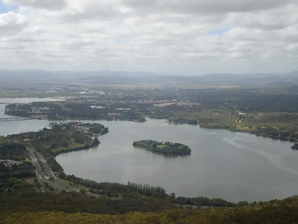
An aerial view of a large lake with an island, surrounded by low green city suburbs and wooded hills.
Picture: Bradii. CC BY 2.0.

Canberra

Where
Australia
When
Design competition won in 1912; Parliament moved there in 1927
Who
Walter Burley Griffin and Marion Mahony Griffin, American architects

Sydney and Melbourne both wanted to be Australia's capital, so a new city was built between them. An American husband and wife, Walter Burley Griffin and Marion Mahony Griffin, won the international design competition in 1912; Marion's beautiful drawings helped win it. Their plan uses the hills and a large central lake, now Lake Burley Griffin (pictured), with long straight axes linking the main buildings and the landscape.

Spot it by

A planned capital around a big artificial lake.

Remember

Canberra is a capital planned by a couple.
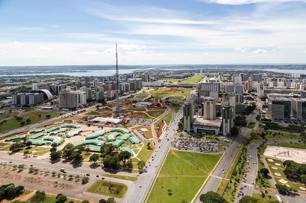
An aerial view of a modern city with a very wide central avenue of lawns, government buildings in a row and a tall TV tower, with a lake in the distance.
Picture: Governo do Brasil. CC BY 3.0 br.

Brasília

Where
Central Brazil
When
Planned from 1957; inaugurated 21 April 1960
Who
Lúcio Costa (plan) and Oscar Niemeyer (buildings), for President Juscelino Kubitschek

Brazil moved its capital from Rio de Janeiro on the coast to the empty centre of the country, to spread growth inland. Lúcio Costa's plan is shaped like an aeroplane or a bird. The body is the Monumental Axis (pictured), a huge avenue with government buildings, and the long curved wings hold housing blocks called superquadras. At the nose, the three branches of government face each other in the Square of the Three Powers. Oscar Niemeyer designed its famous white curving buildings. Critics say it was planned for cars, not for people on foot.

Spot it by

A city plan shaped like an aeroplane, and white curving modernist buildings.

Remember

Costa drew the plane; Niemeyer built the buildings.

When cities grow too fast

Most cities are not planned in one go. They grow bit by bit, often faster than roads, pipes and homes can be built.

Problem What it is What helps
Sprawl The city spreads outward in low, spread-out suburbs, so people need cars for everything Compact growth, mixed uses and good public transport
Urban heat island Concrete, asphalt and few trees make a city hotter than the country around it, especially at night Trees, parks, water bodies and light-coloured roofs
Informal settlements Crowded homes built without plans or services, such as Dharavi in Mumbai Safe tenure, water and sanitation, and upgrading homes where they are
Traffic jams More cars than roads can carry, causing delays and pollution Metros, buses, cycle lanes and walkable streets

Moving people

Transit-oriented development (TOD) means building homes, offices and shops close together within walking distance of a metro or bus station, so people can live without a car.

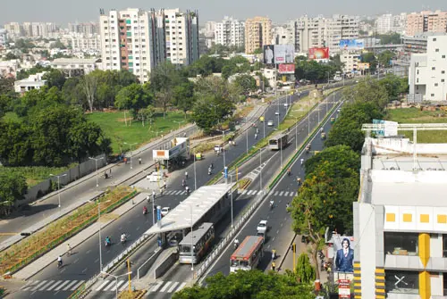
A wide city road seen from above, with a glass-roofed bus station and red buses in a separate lane in the middle of the road.
Picture: Amcanada. CC BY 3.0.

Janmarg

Also called Ahmedabad BRTS

Where
Ahmedabad, Gujarat
When
Opened 14 October 2009
Who
Ahmedabad Municipal Corporation, with CEPT University as planner

A bus rapid transit system (BRTS) gives buses their own lanes, usually in the middle of the road, with stations where people board at the level of the bus floor, like a metro on wheels. Janmarg ("people's way") was planned with CEPT University in Ahmedabad and won the international Sustainable Transport Award for 2010. Buses in their own lane avoid the traffic jam beside them.

Spot it by

Buses in a separate central lane, with island stations in the middle of the road.

Remember

Janmarg is the people's way.

Firsts in Indian city transport

What Where When
First metro in India Kolkata, Esplanade to Bhowanipur (now Netaji Bhavan) 24 October 1984
Delhi Metro's first line Delhi 2002
Janmarg BRTS Ahmedabad 2009

City missions of the Government of India

Mission Launched Aim
Smart Cities Mission 25 June 2015 Make 100 chosen cities better run and more liveable, using technology and new projects
AMRUT (Atal Mission for Rejuvenation and Urban Transformation) June 2015 Give every home in about 500 cities a water tap and sewer connection, and add parks and green spaces

Thinkers who changed how we see cities

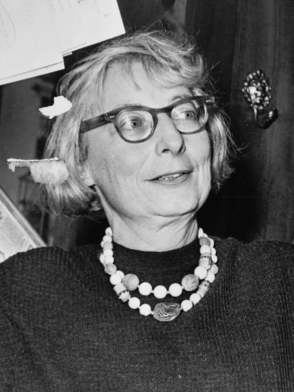
A black and white photo of a woman with short grey hair, large round glasses and a chunky bead necklace, at a press conference.
Picture: Phil Stanziola. Public domain.

Jane Jacobs

Where
New York, later Toronto
When
The Death and Life of Great American Cities, 1961
Who
Jane Jacobs, American-Canadian writer and activist (1916 to 2006)

In the 1950s, planners in American cities were knocking down old neighbourhoods for highways and tall housing blocks. Jacobs, a writer who lived in Greenwich Village in New York, argued that they were destroying what makes a city work: busy streets with shops and homes mixed together, short blocks, old and new buildings side by side, and neighbours who keep an eye on the street. She led the fight that stopped a planned expressway through Lower Manhattan.

Spot it by

The idea of "eyes on the street": busy, mixed streets are safe streets.

Remember

Jacobs stood up for the street.
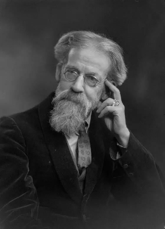
A black and white photo of an old man with a long white beard and glasses, resting his head on his hand.
Picture: Lafayette Ltd, National Portrait Gallery, London. Public domain.

Patrick Geddes

Where
Scotland and India
When
In India from 1914 to the 1920s
Who
Patrick Geddes, Scottish biologist and town planner

Geddes believed a planner must first study a place carefully, its people, work, history and water, before changing it. He called this the survey before plan. Invited to India in 1914, he wrote about 50 reports on Indian towns, including Indore and Lucknow. Instead of clearing whole old neighbourhoods, as colonial officials often did, he suggested conservative surgery: removing only the worst buildings, opening small spaces and restoring old tanks and wells, while keeping the life of the area.

Spot it by

Survey first, then gentle repair.

Remember

Geddes used a scalpel, not a bulldozer.

Timeline

  1. About 2500 BCE

    Mohenjo-daro is built with grid streets and covered drains

  2. 1727

    Sawai Jai Singh II founds Jaipur, planned by Vidyadhar Bhattacharya

  3. 1791

    Pierre L'Enfant plans Washington, D.C.

  4. 1853

    Haussmann begins rebuilding Paris for Napoleon III

  5. 1860

    Cerdà's plan for the Eixample in Barcelona

  6. 1898

    Ebenezer Howard publishes his Garden City book

  7. 1911

    The capital of British India is moved from Calcutta to Delhi

  8. 1912

    Walter Burley Griffin and Marion Mahony Griffin win the Canberra competition

  9. 1914

    Patrick Geddes arrives in India

  10. 1931

    New Delhi is inaugurated

  11. 1948

    Bhubaneswar becomes the capital of Odisha

  12. 1950

    Le Corbusier takes over the plan for Chandigarh

  13. 1960

    Brasília becomes Brazil's capital

  14. 1961

    Jane Jacobs publishes The Death and Life of Great American Cities

  15. 1968

    Auroville is founded

  16. 1971

    Planning begins for Navi Mumbai

  17. 1984

    India's first metro opens in Kolkata

  18. 2009

    Ahmedabad's Janmarg BRTS opens

  19. 2015

    The Smart Cities Mission and AMRUT are launched

  20. 2021

    Dholavira becomes a World Heritage Site

Test yourself

Question 1 of 8

This brick tank belongs to which ancient city?

Question 2 of 8

Who planned the city of Jaipur in 1727?

Question 3 of 8

Which city's plan is shaped like an aeroplane?

Question 4 of 8

This diagram shows which idea?

Question 5 of 8

Which city is laid out in blocks with cut-off corners, planned by Ildefons Cerdà?

Question 6 of 8

Where did India's first metro open, in 1984?

Question 7 of 8

In which city does this bus rapid transit system, Janmarg, run?

Question 8 of 8

Who wrote The Death and Life of Great American Cities (1961)?

From past papers

Real exam questions on this topic, each with a full solution.

Finished this note?

Mark it as studied to track your progress through the course.

Was this note useful?

Each picture is credited underneath it. Pictures of works still in copyright are shown small, for teaching only. If you hold the rights to a picture and want it removed, tell us through the contact page and we will take it down.