Chapter 10: Environment, climate and sustainable design
India's climate and ecosystems
India's monsoon, its wettest and driest places, its main soils and forests, and its protected areas, from Jim Corbett to Ramsar sites, with every count dated October 2026.
1The south-west monsoon brings most of India's rain, from June to September. Its normal start date over Keralam (Kerala until 2026) is 1 June; in 2026 it arrived on 4 June.
2Mawsynram in Meghalaya has the highest average rainfall in the world. Nearby Cherrapunji (Sohra) holds the records for the wettest month and the wettest year. Ladakh and western Rajasthan get less than 10 cm a year.
3Alluvial soil covers the northern plains. Black soil (regur) of the Deccan is best for cotton. Laterite forms where heat and heavy rain wash the soil out.
4Jim Corbett, opened in 1936 as Hailey National Park, was India's first national park. Project Tiger began in 1973, and India has 58 tiger reserves as of October 2026.
5As of October 2026, India has 18 biosphere reserves, 13 of them in UNESCO's world network, and 103 Ramsar sites.
6India has parts of four of the world's 36 biodiversity hotspots. Cheetahs returned to India at Kuno National Park in 2022.
The monsoon
A monsoon is a wind that changes direction with the seasons; the word comes from the Arabic mausim, meaning season. In summer the land heats up much faster than the sea, so warm air rises over north-west India and moist air rushes in from the ocean to the south-west. In winter it turns round, and dry winds blow from the land out to sea from the north-east.
Reaches Keralam first, then spreads north to cover the whole country by early July
When
June to September; the normal start date over Keralam is 1 June
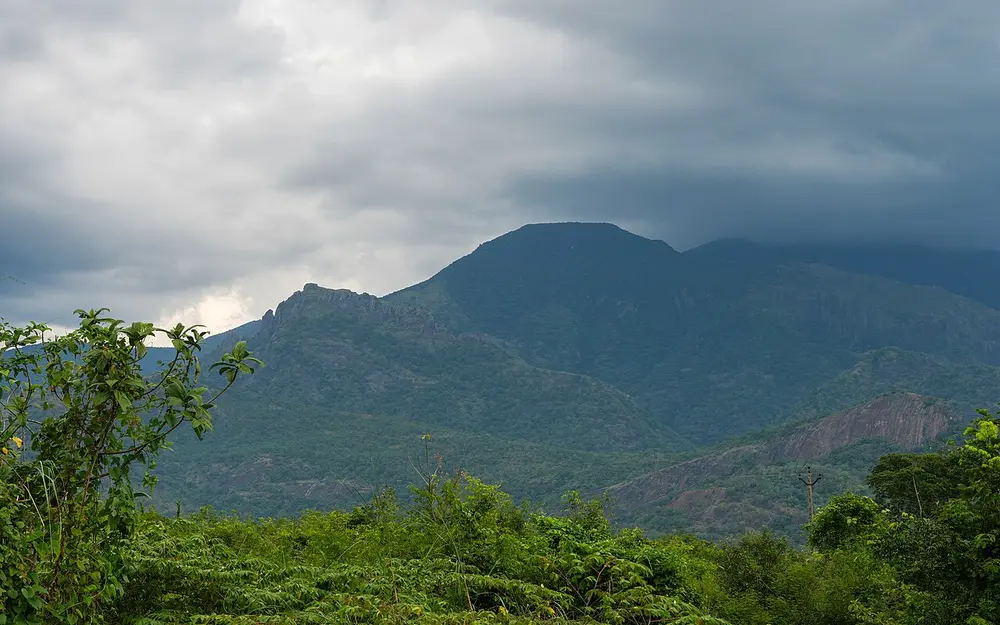
It brings about three-quarters of India's yearly rain. It arrives in two branches: the Arabian Sea branch hits the Western Ghats, and the Bay of Bengal branch hits the north-east and then turns west along the Himalaya. The India Meteorological Department (IMD) declares the onset over Keralam when rain, wind and cloud reach set levels; in 2026 it declared it on 4 June, three days after the normal date.
Spot it by
Heavy clouds piling up against the Western Ghats (pictured in August, near Rajapalayam in Tamil Nadu).
Remember
South-west monsoon, June to September, Keralam first.
Don't confuse
The side of a mountain facing the wind gets the rain. The far side, in the rain shadow, stays dry, which is why Mumbai is far wetter than Pune.
Season (IMD)
Months
What happens
Winter
January and February
Cool and dry; winds from the west bring snow to the Himalaya and some rain to the north-west
Summer
March to May
Hot; the dry, dusty loo wind blows across the northern plains
South-west monsoon
June to September
The main rains, over most of the country
Post-monsoon
October to December
The monsoon retreats; the north-east monsoon gives Tamil Nadu its main rain; cyclones form in the Bay of Bengal
The retreating and north-east monsoon. In October and November the south-west monsoon pulls back from the north first. As the winds turn round and blow from the north-east, they cross the Bay of Bengal, pick up moisture and drop it on the Tamil Nadu coast. That is why Chennai's wettest months are October to December, not July.
El Niño and the monsoon. El Niño is a warming of the sea surface in the eastern Pacific Ocean, off South America, every few years. Peruvian fishermen named it after the Christ Child (El Niño means the boy in Spanish), because the warm water usually turned up around Christmas. El Niño years often bring a weaker monsoon and drought in India. Its opposite, a cooling of the same waters, is La Niña, the girl.
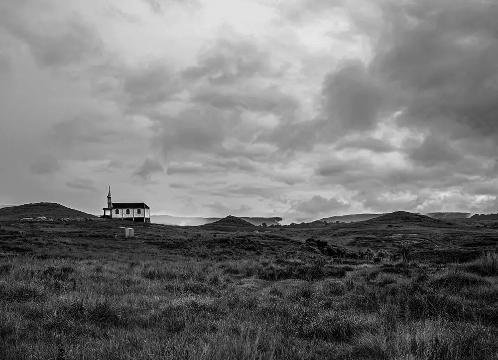
Often called the wettest place on Earth, with an average of nearly 11,900 mm (about 12 metres) of rain a year. Moist winds from the Bay of Bengal are funnelled into the Khasi Hills and forced to rise up their steep slopes, so they drop their water.
Spot it by
A village on bare, grassy hills under almost permanent cloud (pictured).
Remember
Mawsynram for the highest average; Cherrapunji for the single-year record.
Don't confuse
A couple of places in Colombia report similar or higher averages, so the title is sometimes disputed. Indian textbooks give it to Mawsynram.
Khasi Hills, Meghalaya, about 15 km east of Mawsynram
When
Record year August 1860 to July 1861
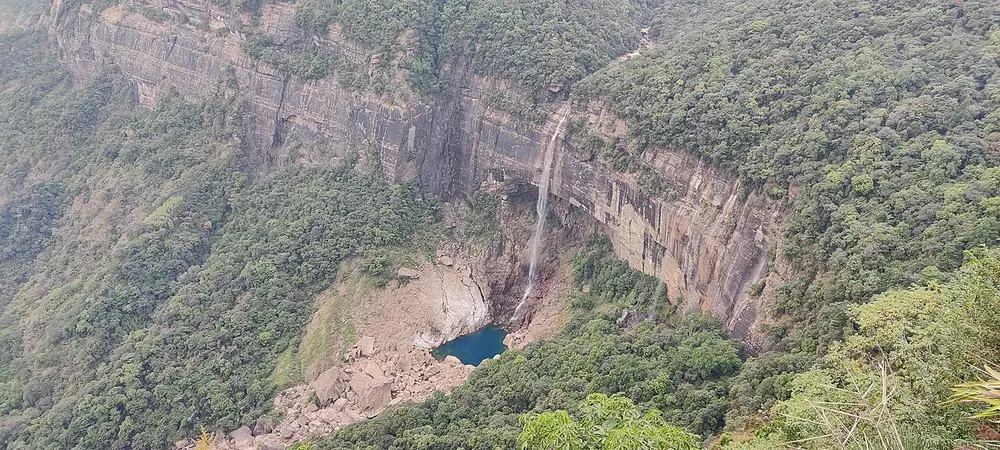
For a long time it was called the wettest place on Earth, until records showed Mawsynram's average was higher. It still holds two world records: about 26,000 mm (26 metres) of rain in the twelve months from August 1860 to July 1861, and 9,300 mm in the single month of July 1861.
Spot it by
Nohkalikai Falls near the town (pictured), one of the tallest plunge waterfalls in India.
Remember
Sohra is the local Khasi name; Cherrapunji is the old spelling.
Western Rajasthan, around Jaisalmer, Barmer and Bikaner, running into Pakistan
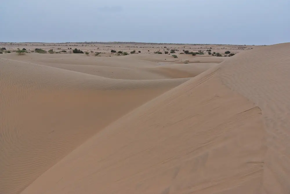
Together with the cold desert of Ladakh, the driest part of India: both get less than 10 cm of rain in a year. Jaisalmer, in the heart of the Thar, is the classic exam answer for India's driest city.
Spot it by
Sand dunes with scattered thorny bushes near Jaisalmer (pictured).
Remember
Wettest, Mawsynram, more than 1,100 cm. Driest, Ladakh and Jaisalmer, under 10 cm.
Don't confuse
Ladakh is a cold desert: high, freezing and dry, with bare rock instead of dunes.
Soils
Indian textbooks (NCERT) sort the country's soils into six main kinds.
Soil
Where
Why it's like that
What it grows
Alluvial
The northern plains (Indus, Ganga, Brahmaputra) and the deltas of the east coast
Silt laid down by rivers; the most widespread soil in India
Wheat, rice, sugarcane, pulses
Black (regur)
The Deccan: Maharashtra, Gujarat, Madhya Pradesh and the Godavari and Krishna valleys
Formed from lava rock; holds water well and cracks when it dries
Cotton, hence the name black cotton soil
Red and yellow
The eastern and southern Deccan, Odisha and Chhattisgarh
Iron in the rock makes it red; it looks yellow when it is wet through
Millets, pulses, groundnut
Laterite
Keralam, Karnataka, Tamil Nadu, Odisha and the hills of Assam and Meghalaya
Heat and heavy rain wash out the nutrients and leave iron behind
Tea, coffee and cashew, with plenty of manure
Arid (desert)
Western Rajasthan
Sandy and often salty, with little rotted plant matter
The Deccan Plateau, mainly Maharashtra, Gujarat and Madhya Pradesh
Made with
Weathered basalt, the dark lava rock of the Deccan
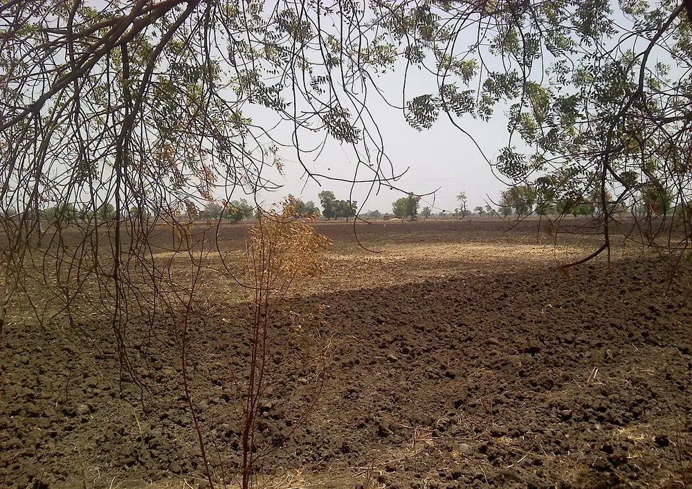
A heavy, clay-rich soil that holds moisture for a long time, so crops survive between rains. It swells when wet and shrinks into deep cracks when dry, which lets air into the ground. Cotton grows so well in it that it is named after the crop.
Spot it by
Dark, clumpy earth on a farm waiting for rain (pictured).
Western Ghats, Keralam, Karnataka, Goa and the hills of the east and north-east
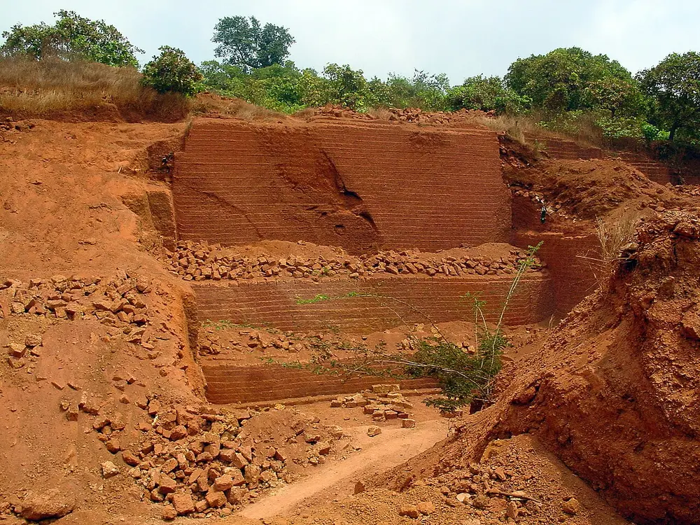
Laterite forms where it is hot and very wet. The heavy rain washes most nutrients deep down, a process called leaching, and leaves behind red iron and aluminium. The name comes from the Latin later, a brick, because the soil hardens in air and is cut into building blocks.
Spot it by
Red earth cut into blocks in a quarry near Goa (pictured).
Remember
Laterite, later, brick.
Don't confuse
Red soil is also red from iron, but it forms in drier places and isn't washed out in the same way.
Forests
Forest type
Rain a year
Where
Typical trees
Tropical evergreen (rainforest)
More than 200 cm
Western Ghats, the north-east, Andaman and Nicobar Islands
Ebony, mahogany, rosewood, rubber
Tropical deciduous (monsoon forest)
70 to 200 cm
The most widespread type, across central and peninsular India
Teak, sal, sandalwood, bamboo; trees shed leaves in the dry season
Thorn forest and scrub
Less than 70 cm
Rajasthan, Gujarat and the dry inner Deccan
Babool (acacia), khair, cactus, euphorbia
Montane (mountain)
Changes with height
The Himalaya and the Nilgiris
Oak and chestnut lower down; deodar, pine, fir and spruce higher up
Mangrove
Tidal coasts
The deltas of the Ganga, Mahanadi, Godavari and Krishna, and the Andamans
Sundari and other trees that grow in salty mud
Deciduous means the trees drop their leaves in one season. Evergreen forests never lose them all at once, so they look green all year.
The delta of the Ganga and Brahmaputra, in West Bengal and Bangladesh
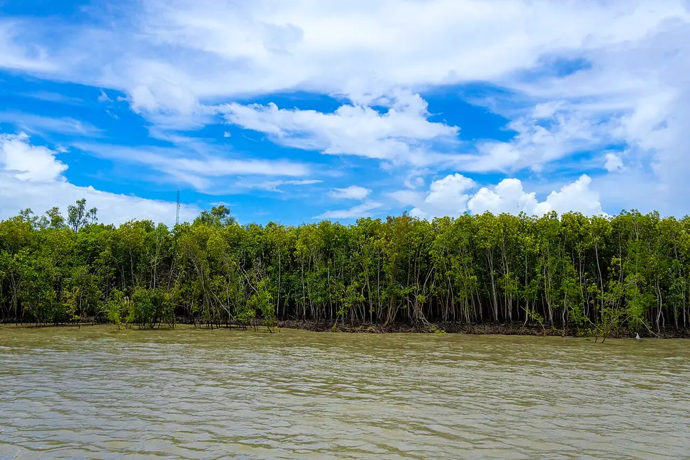
The largest mangrove forest in the world. Mangroves are trees that grow in salty tidal water, on roots that rise above the mud so they can breathe. The forest is named after its most common tree, the sundari. It is home to Bengal tigers that swim between islands, and the Indian part is a national park, tiger reserve, biosphere reserve, World Heritage Site and Ramsar site all at once.
Spot it by
Mangroves standing in water at high tide (pictured).
Remember
The Sundarbans got its name from the sundari tree.
Don't confuse
Bhitarkanika in Odisha is India's second big mangrove forest, famous for its saltwater crocodiles.
Protected areas
India protects wild places in several ways:
National park: the strictest kind. No hunting, grazing or farming inside.
Wildlife sanctuary: looser rules; some local use may be allowed.
Tiger reserve: a protected core where tigers live undisturbed, with a buffer zone around it where people live and work. States declare them on the advice of the National Tiger Conservation Authority (NTCA).
Biosphere reserve: a very large area, often several parks together, where people still live in the outer zones. The idea comes from UNESCO's Man and the Biosphere programme.
Ramsar site: a wetland of international importance, listed under the Ramsar Convention on Wetlands (1971).
Also called Hailey National Park, then Ramganga National Park
Where
Nainital district, Uttarakhand, along the Ramganga river
When
Set up in 1936; renamed after Jim Corbett in the mid-1950s
Who
Named after Jim Corbett, a hunter turned naturalist and author who helped create it
India's first national park. It opened in 1936 as Hailey National Park, after Malcolm Hailey, the British governor of the province, was renamed Ramganga National Park after independence, and then Corbett National Park. It was one of the first nine tiger reserves when Project Tiger began in 1973.
Spot it by
Grasslands at Dhikala with sal forest behind (pictured).
Government of India; run today by the National Tiger Conservation Authority (NTCA)
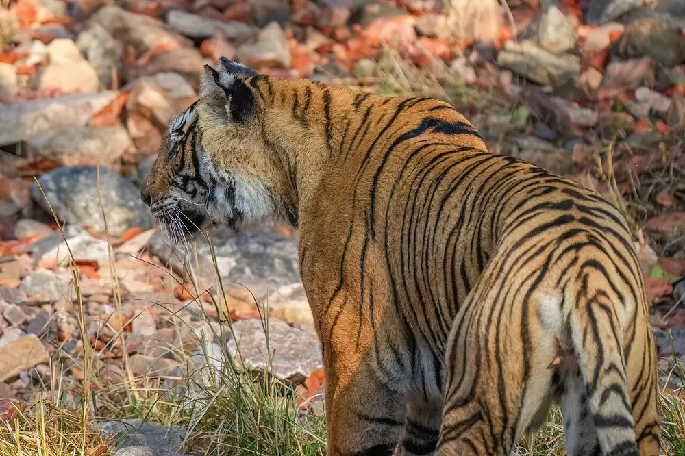
Tigers were being hunted and their forests cut so fast that the government set up special reserves for them, nine at the start. As of October 2026 there are 58 tiger reserves, the newest being Madhav in Madhya Pradesh (March 2025). The 2022 tiger count estimated 3,682 wild tigers in India, about three-quarters of the world's total.
Spot it by
A Bengal tiger in Ranthambore (pictured), one of the original nine reserves of 1973.
The Ministry of Environment, Forest and Climate Change
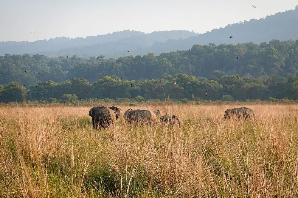
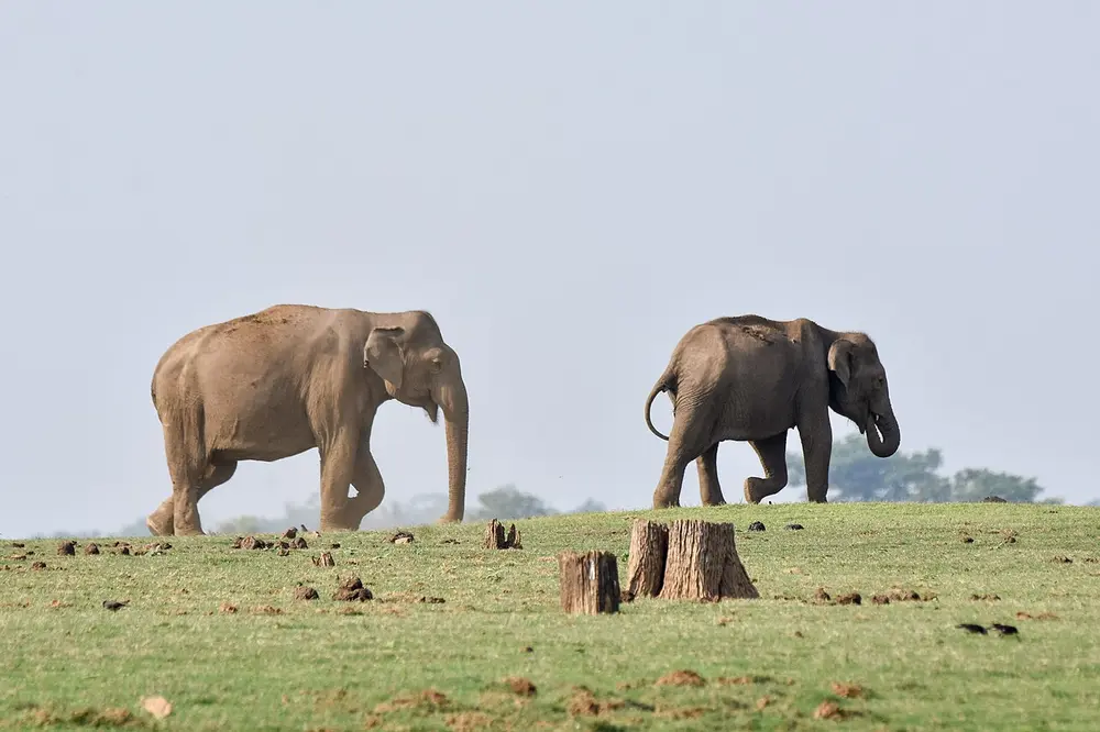
A national programme to protect wild elephants, their forests and the corridors they walk between forests, and to reduce clashes between elephants and people. Unlike Project Tiger, it works through elephant reserves that overlap with other protected areas. The Indian elephant is India's National Heritage Animal.
Spot it by
Asian elephants in Nagarhole, Karnataka (pictured), part of the Nilgiri Biosphere Reserve.
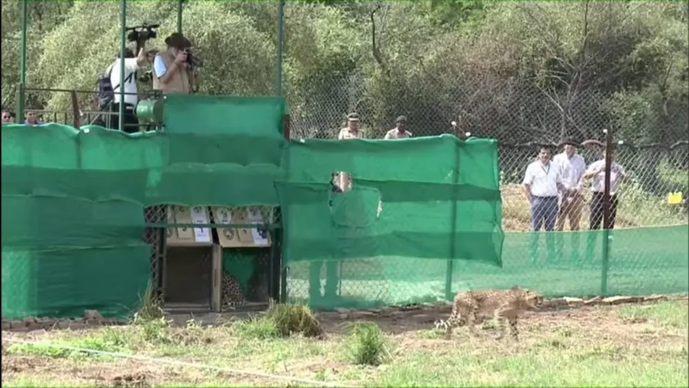
The cheetah died out in India and was declared extinct here in 1952, after years of hunting and the loss of its grasslands. In September 2022 eight African cheetahs were flown in from Namibia and released at Kuno, and twelve more came from South Africa in February 2023. In March 2023 the first cheetah cubs in over 70 years were born in India.
Spot it by
A cheetah leaving its crate at the first release in Kuno, 17 September 2022 (pictured).
Don't confuse
These are African cheetahs. India's own kind, the Asiatic cheetah, now survives only in Iran.
Biosphere reserves
As of October 2026, India has 18 biosphere reserves. 13 of them are also in UNESCO's World Network of Biosphere Reserves. The first was the Nilgiri Biosphere Reserve (1986), and the newest to join UNESCO's network is the Cold Desert reserve in Himachal Pradesh (September 2025).
Biosphere reserve
State
Joined UNESCO's network
Nilgiri
Tamil Nadu, Keralam, Karnataka
2000
Gulf of Mannar
Tamil Nadu
2001
Sundarban
West Bengal
2001
Nanda Devi
Uttarakhand
2004
Nokrek
Meghalaya
2009
Pachmarhi
Madhya Pradesh
2009
Similipal
Odisha
2009
Achanakmar-Amarkantak
Madhya Pradesh, Chhattisgarh
2012
Great Nicobar
Andaman and Nicobar Islands
2013
Agasthyamala
Keralam, Tamil Nadu
2016
Khangchendzonga
Sikkim
2018
Panna
Madhya Pradesh
2020
Cold Desert
Himachal Pradesh
2025
The other five, Manas, Dibru-Saikhowa, Dehang-Dibang, the Great Rann of Kutch and Seshachalam, are Indian biosphere reserves that aren't in UNESCO's network.
Ramsar sites
The Ramsar Convention is a world treaty to protect wetlands, signed at Ramsar in Iran in 1971. India joined in 1982. As of October 2026, India has 103 Ramsar sites. Tamil Nadu has more than any other state.
One of India's first two Ramsar sites, 1 October 1981
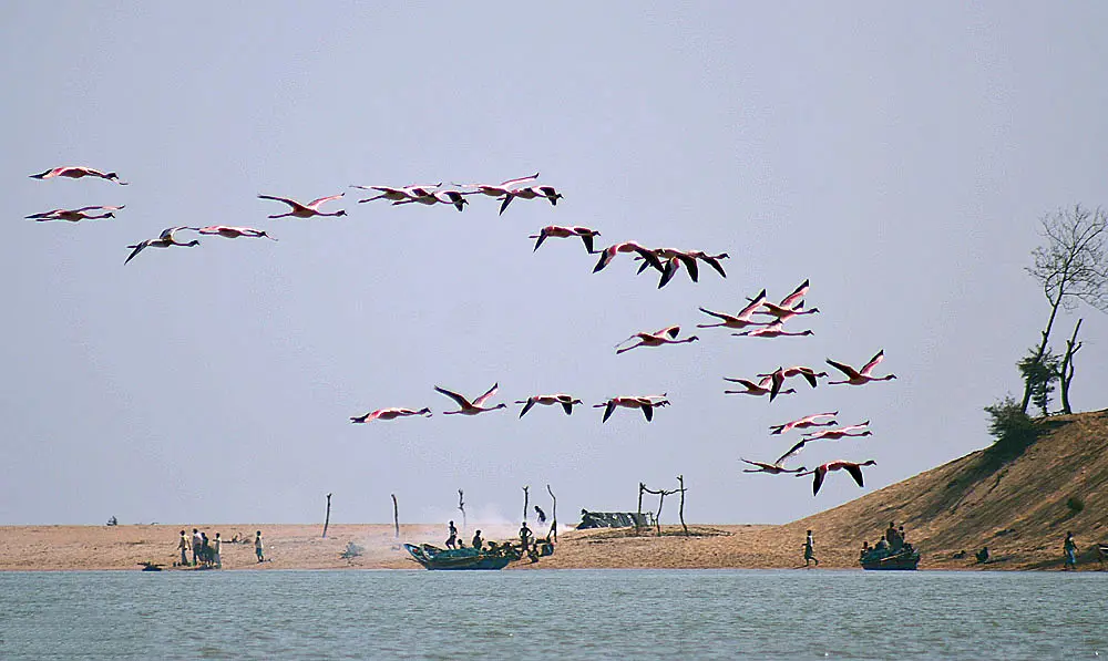
The largest saltwater (brackish) lagoon in India, where the sea mixes with river water. It was listed as a Ramsar site in 1981, together with Keoladeo in Rajasthan. Pollution put it on the Ramsar danger list, the Montreux Record, in 1993; after a clean-up it was taken off in 2002. It is famous for Irrawaddy dolphins and for winter birds such as flamingos.
Spot it by
Flamingos flying over the lagoon (pictured).
Remember
Chilika and Keoladeo, 1981, India's first Ramsar sites.
Don't confuse
Wular Lake in Kashmir is India's largest freshwater lake, and also a Ramsar site.
Wetland
State
Remember it for
Chilika
Odisha
Largest brackish lagoon in India; first Ramsar site (1981)
Keoladeo
Rajasthan
First Ramsar site (1981); bird sanctuary
Wular
Jammu and Kashmir
Largest freshwater lake in India
Loktak
Manipur
Floating islands of plants called phumdis
Sundarban Wetland
West Bengal
India's largest Ramsar site
Sukhna Wetland and Sauj Jheel
Chandigarh and Uttar Pradesh
The newest, added on 15 October 2026 (sites 102 and 103)
Biodiversity hotspots
A biodiversity hotspot is a region with a very large number of plants found nowhere else (at least 1,500 kinds) that has already lost at least 70 percent of its natural habitat. The idea came from the ecologist Norman Myers in 1988, and the group Conservation International keeps the list. There are 36 hotspots in the world, and India has parts of four:
The Himalaya
Indo-Burma: most of north-east India
The Western Ghats and Sri Lanka
Sundaland: which reaches India in the Nicobar Islands
The mountain chain along India's west coast, from Gujarat to Keralam, together with Sri Lanka
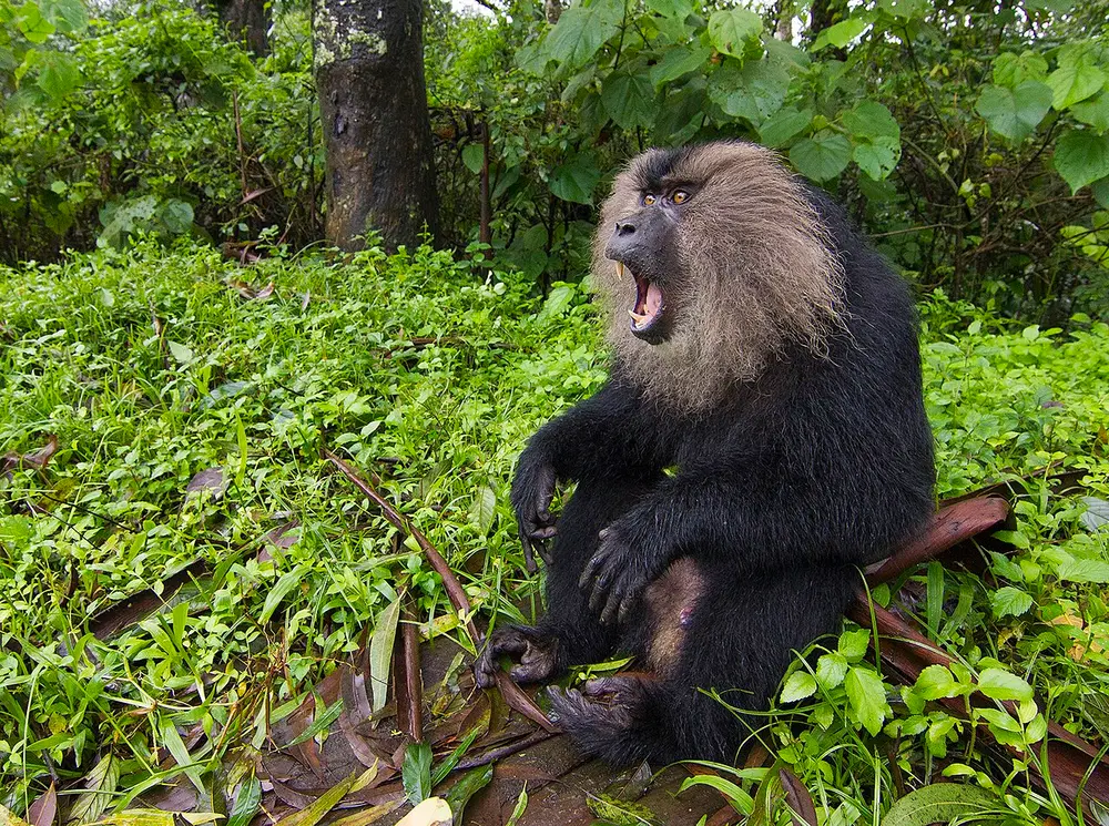
The rainforests of the Western Ghats hold hundreds of plants, frogs and animals found nowhere else. The Western Ghats are also a World Heritage Site (2012).
Spot it by
The lion-tailed macaque (pictured, in the Anaimalai hills), a monkey found only in the Western Ghats, with its lion-like silver mane.
Remember
Four hotspots: Himalaya, Indo-Burma, Western Ghats, Sundaland.
1936
Hailey National Park, now Jim Corbett, becomes India's first national park
1952
The cheetah is declared extinct in India
1973
Project Tiger begins with nine tiger reserves
1981
Chilika and Keoladeo become India's first Ramsar sites
1986
Nilgiri becomes India's first biosphere reserve
1992
Project Elephant begins
2022
Eight cheetahs from Namibia are released at Kuno
2025
Madhav becomes the 58th tiger reserve; Cold Desert becomes the 13th UNESCO biosphere reserve
2026
Sukhna Wetland and Sauj Jheel take India to 103 Ramsar sites
Test yourself
Question 1 of 8
Which forest, seen here at high tide, is the largest mangrove forest in the world?
Question 2 of 8
This red soil is cut into building blocks. Which soil is it?
Question 3 of 8
Which national park is matched with the right state?
Question 4 of 8
The famous bird lagoon pictured here is India's largest saltwater lake. Which is it?
Question 5 of 8
These animals were released at Kuno National Park in September 2022. Where did the first group come from?
Question 6 of 8
Which place has the highest average rainfall in the world?
Question 7 of 8
Where does the name El Niño come from?
Question 8 of 8
As of October 2026, how many of India's biosphere reserves are in UNESCO's world network?
From past papers
Real exam questions on this topic, each with a full solution.
Mark it as studied to track your progress through the course.
Was this note useful?
Each picture is credited underneath it. Pictures of works still in copyright are shown small, for teaching only. If you hold the rights to a picture and want it removed, tell us through the contact page and we will take it down.