India's 28 states and 8 union territories with their capitals, the biggest and smallest, the Tropic of Cancer states, India's neighbours and borders, its islands and its farthest points.
1As of October 2026 India has 28 states and 8 union territories. Jammu and Kashmir and Ladakh have been union territories since 31 October 2019.
2Rajasthan is the largest state by area and Goa the smallest; Uttar Pradesh has the most people and Sikkim the fewest.
3The Tropic of Cancer crosses eight states: Gujarat, Rajasthan, Madhya Pradesh, Chhattisgarh, Jharkhand, West Bengal, Tripura and Mizoram.
4India's longest land border is with Bangladesh; Gujarat has the longest coastline.
5Indian Standard Time is set by the 82.5 degrees east line, which passes near Mirzapur in Uttar Pradesh.
6Amaravati became Andhra Pradesh's capital by law in April 2026, and Kerala was officially renamed Keralam on 25 August 2026.
States and union territories
India is a union of states and union territories. A state has its own elected government, led by a Chief Minister. A union territory is run mainly by the central government through a Lieutenant Governor or Administrator, though Delhi, Puducherry and Jammu and Kashmir also have elected assemblies.
As of October 2026 there are 28 states and 8 union territories. India covers about 3.28 million sq km, which makes it the seventh-largest country in the world.
Also called The National Capital Territory of Delhi
Where
Capital: New Delhi
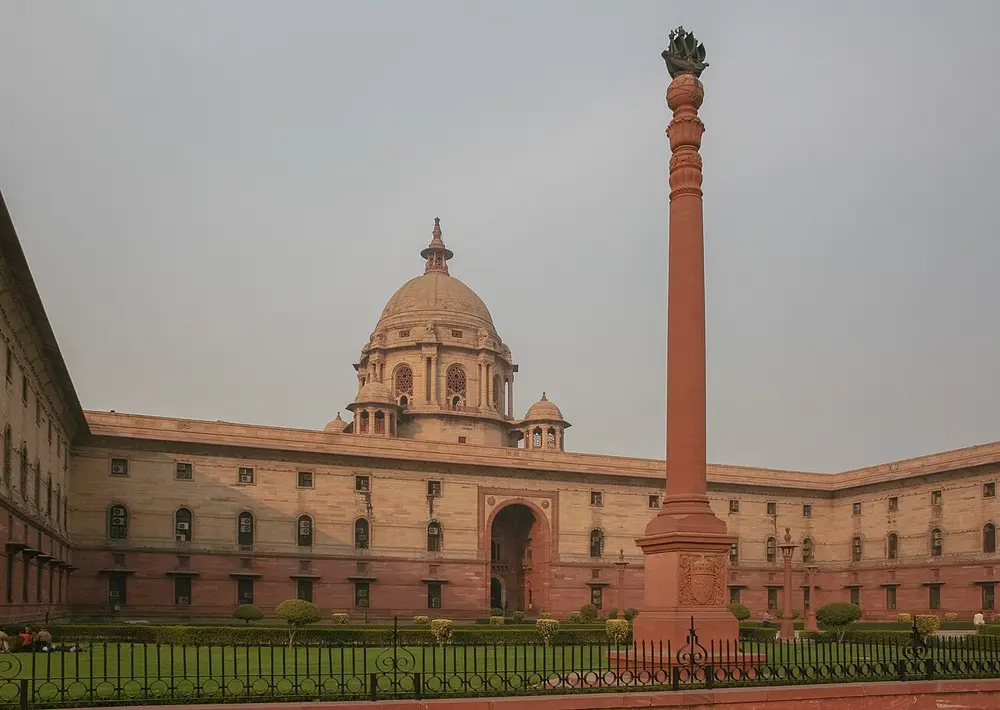
New Delhi is the capital of India. Delhi is a union territory with its own elected assembly and Chief Minister, which makes it different from most union territories. Rashtrapati Bhavan (pictured), the home of the President, stands at one end of the Kartavya Path.
Remember
New Delhi is the capital; Delhi is the territory around it.
The biggest and the smallest
Areas are in thousand square kilometres, rounded, from the 2011 Census. Populations are also from the 2011 Census, the latest full count as of October 2026.
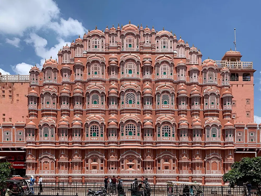
At about 342,000 sq km, Rajasthan is the largest state, a little over a tenth of India. Most of the Thar Desert is here, and it has a long border with Pakistan. Its capital Jaipur is the Pink City, and the Hawa Mahal (pictured) is its best-known building.
Remember
Rajasthan is the largest state; Madhya Pradesh and Maharashtra come next.
Also called The smallest state by area; the 25th state
Where
Capital: Panaji
When
State since 30 May 1987
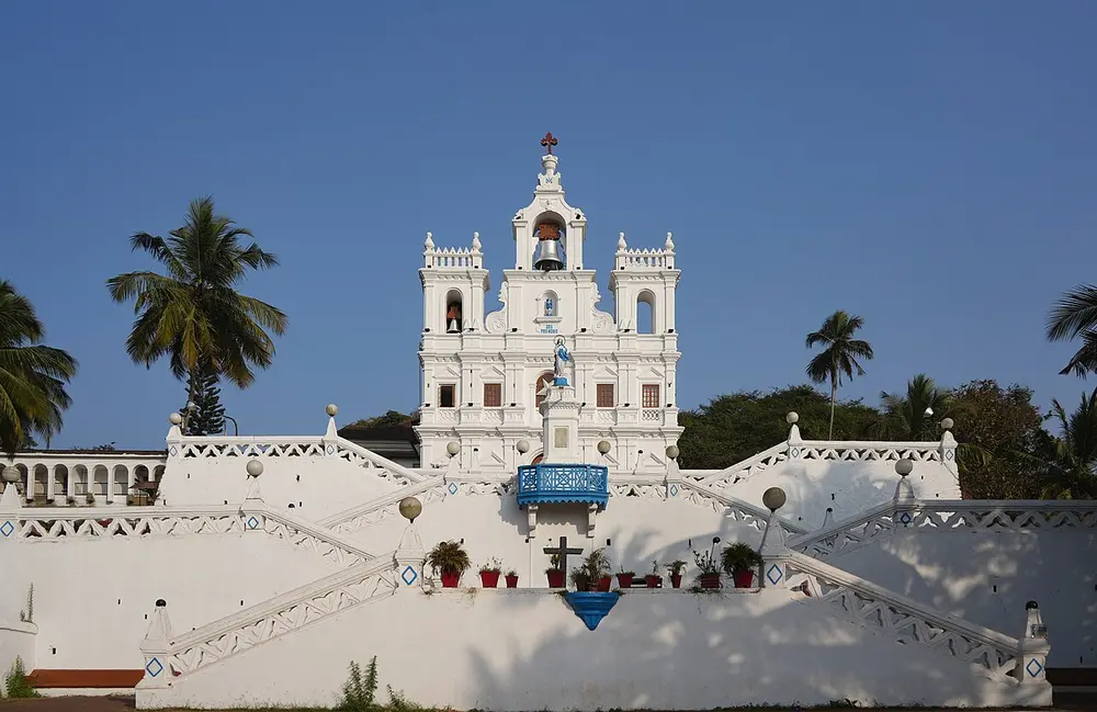
Goa is the smallest state, at about 3,700 sq km. It was ruled by Portugal for over 450 years and joined India in 1961. It was a union territory until 1987, when it became India's 25th state. The church of Our Lady of the Immaculate Conception (pictured) stands in the centre of Panaji.
Almost 200 million people lived in Uttar Pradesh in 2011, about one Indian in six, more than in most countries. It sends the most members to the Lok Sabha, 80. Its capital Lucknow, on the Gomti river, is home to the state assembly, the Vidhan Bhawan (pictured).
Remember
UP has the most people; Maharashtra and Bihar come next.
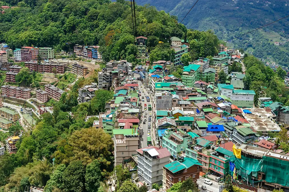
About 610,000 people lived in Sikkim in 2011, the fewest of any state. It is also the second-smallest state by area, after Goa. A kingdom until 1975, it then became India's 22nd state. Gangtok (pictured) is built along a ridge, and Kangchenjunga can be seen from it.
Remember
Sikkim: fewest people, second-smallest area.
By area
Largest
Smallest
States
Rajasthan, then Madhya Pradesh, Maharashtra
Goa, then Sikkim, Tripura
Union territories
Ladakh
Lakshadweep (32 sq km)
By population (2011)
Most
Fewest
States
Uttar Pradesh, then Maharashtra, Bihar
Sikkim, then Mizoram, Arunachal Pradesh
Union territories
Delhi
Lakshadweep
The newest states and territories
1956
The States Reorganisation Act redraws most states along the lines of language
1975
Sikkim becomes the 22nd state
1987
Mizoram and Arunachal Pradesh become states in February, and Goa becomes the 25th state in May
2000
Chhattisgarh (1 November), Uttarakhand (9 November, first called Uttaranchal) and Jharkhand (15 November) are carved out of Madhya Pradesh, Uttar Pradesh and Bihar
2014
Telangana becomes the newest state on 2 June, carved out of Andhra Pradesh
2019
The state of Jammu and Kashmir becomes two union territories, Jammu and Kashmir and Ladakh, on 31 October
2020
Dadra and Nagar Haveli and Daman and Diu merge into one union territory on 26 January
2026
Parliament names Amaravati as the capital of Andhra Pradesh in law, in April
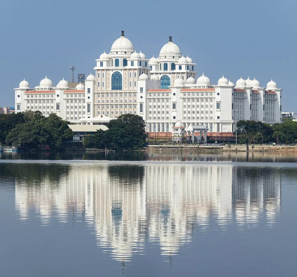
Telangana was carved out of Andhra Pradesh in 2014 and is the newest state. For ten years Hyderabad was the shared capital of both states; since 2 June 2024 it has been Telangana's alone. The domed Dr B.R. Ambedkar Telangana State Secretariat (pictured) stands beside the Hussain Sagar lake.
Remember
The newest state, Telangana, kept the old capital, Hyderabad.
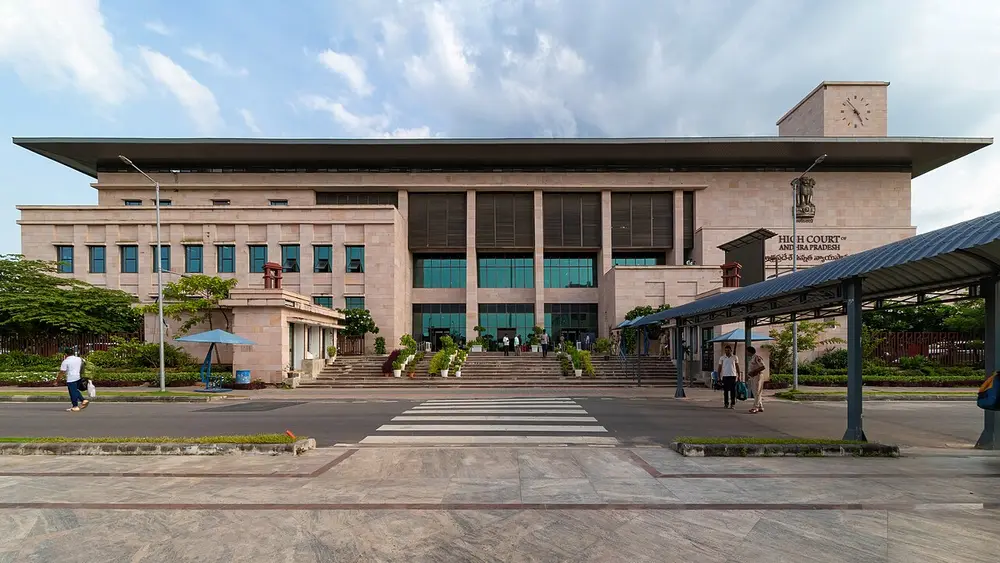
After losing Hyderabad to Telangana, Andhra Pradesh began building a new planned capital, Amaravati, on the Krishna river near Vijayawada. The state's High Court (pictured) already sits there. Plans changed more than once over the years, but in April 2026 Parliament amended the Andhra Pradesh Reorganisation Act to name Amaravati as the capital in law.
Remember
Andhra Pradesh: Amaravati. Telangana: Hyderabad.
Don't confuse
Amaravati is also the name of the ancient Buddhist site on the Krishna famous for its sculpture. The new capital is named after it.
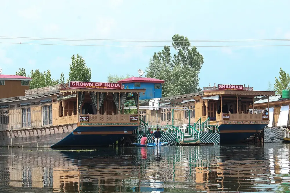
Jammu and Kashmir was a state until 2019, when Parliament made it a union territory with its own elected assembly, and made Ladakh a separate union territory. As of October 2026 statehood has not been restored, though the central government has said it will be. Srinagar, with the houseboats of Dal Lake (pictured), is the summer capital, and Jammu the winter capital.
Remember
Two capitals for two seasons: Srinagar in summer, Jammu in winter.
Capital: Leh, with Kargil as a second seat of government
When
Union territory since 31 October 2019
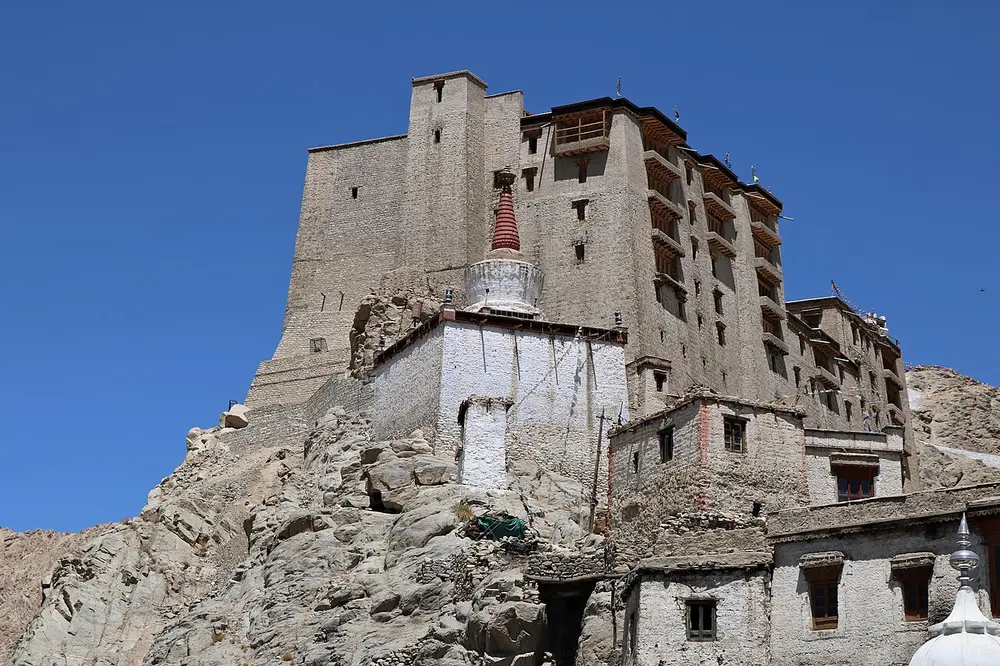
The largest union territory, high, cold and thinly peopled. It borders China in the east. India's official map also shows Gilgit-Baltistan, held by Pakistan, and Aksai Chin, held by China, as part of Ladakh. Leh Palace (pictured), built in the 17th century for the kings of Ladakh, looks over the old town of Leh.
Remember
Ladakh is the biggest union territory and Lakshadweep the smallest.
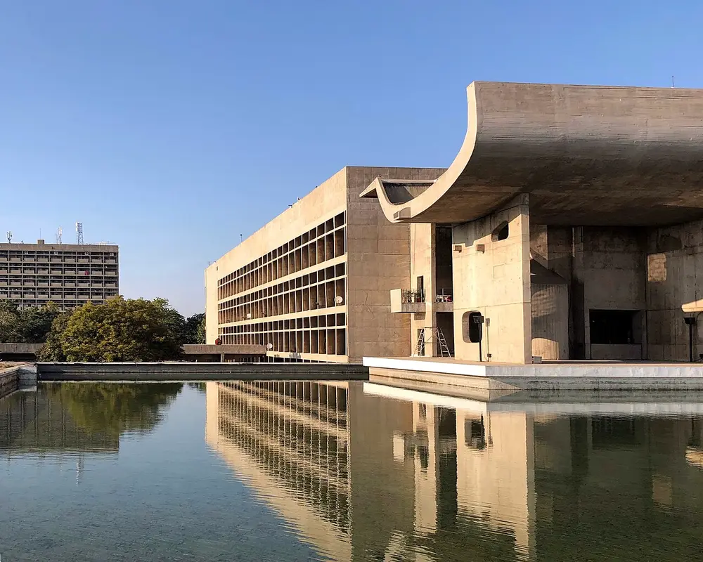
Chandigarh is a union territory and also the capital of both Punjab and Haryana, an arrangement made when Haryana was split from Punjab in 1966. The city was planned in the 1950s by the Swiss-French architect Le Corbusier. His Palace of Assembly (pictured) is part of the Capitol Complex, a World Heritage Site.
Remember
One city, two state capitals, and a union territory of its own.
Union territory
Capital
Remember
Andaman and Nicobar Islands
Sri Vijaya Puram
Called Port Blair until September 2024
Chandigarh
Chandigarh
Also the capital of Punjab and Haryana
Dadra and Nagar Haveli and Daman and Diu
Daman
Two territories merged in January 2020
Delhi
New Delhi
Has an elected assembly and Chief Minister
Jammu and Kashmir
Srinagar (summer), Jammu (winter)
Union territory since 31 October 2019
Ladakh
Leh, with Kargil
Largest union territory; since 31 October 2019
Lakshadweep
Kavaratti
Smallest union territory; coral islands
Puducherry
Puducherry
Old French territory, spread across four separate parts
States and their capitals
Listed from the largest state to the smallest. Area is in thousand square kilometres, rounded.
State
Capital
Area
Rajasthan
Jaipur
342
Madhya Pradesh
Bhopal
308
Maharashtra
Mumbai (Nagpur for the winter session)
308
Uttar Pradesh
Lucknow
241
Gujarat
Gandhinagar
196
Karnataka
Bengaluru
192
Andhra Pradesh
Amaravati
163
Odisha
Bhubaneswar
156
Chhattisgarh
Raipur
135
Tamil Nadu
Chennai
130
Telangana
Hyderabad
112
Bihar
Patna
94
West Bengal
Kolkata
89
Arunachal Pradesh
Itanagar
84
Jharkhand
Ranchi
80
Assam
Dispur
78
Himachal Pradesh
Shimla (Dharamshala in winter)
56
Uttarakhand
Dehradun (Bhararisain, in Gairsain, in summer)
53
Punjab
Chandigarh
50
Haryana
Chandigarh
44
Keralam (Kerala until August 2026)
Thiruvananthapuram
39
Meghalaya
Shillong
22
Manipur
Imphal
22
Mizoram
Aizawl
21
Nagaland
Kohima
17
Tripura
Agartala
10
Sikkim
Gangtok
7
Goa
Panaji
4
Madhya Pradesh is very slightly bigger than Maharashtra, and Meghalaya very slightly bigger than Manipur. Exams often ask you to compare two states, so a few pairs are worth knowing: Arunachal Pradesh is more than twice the size of Keralam, Assam is bigger than Punjab, Chhattisgarh is bigger than Jharkhand, and West Bengal is bigger than Uttarakhand.
About 23.5 degrees north, across the middle of India
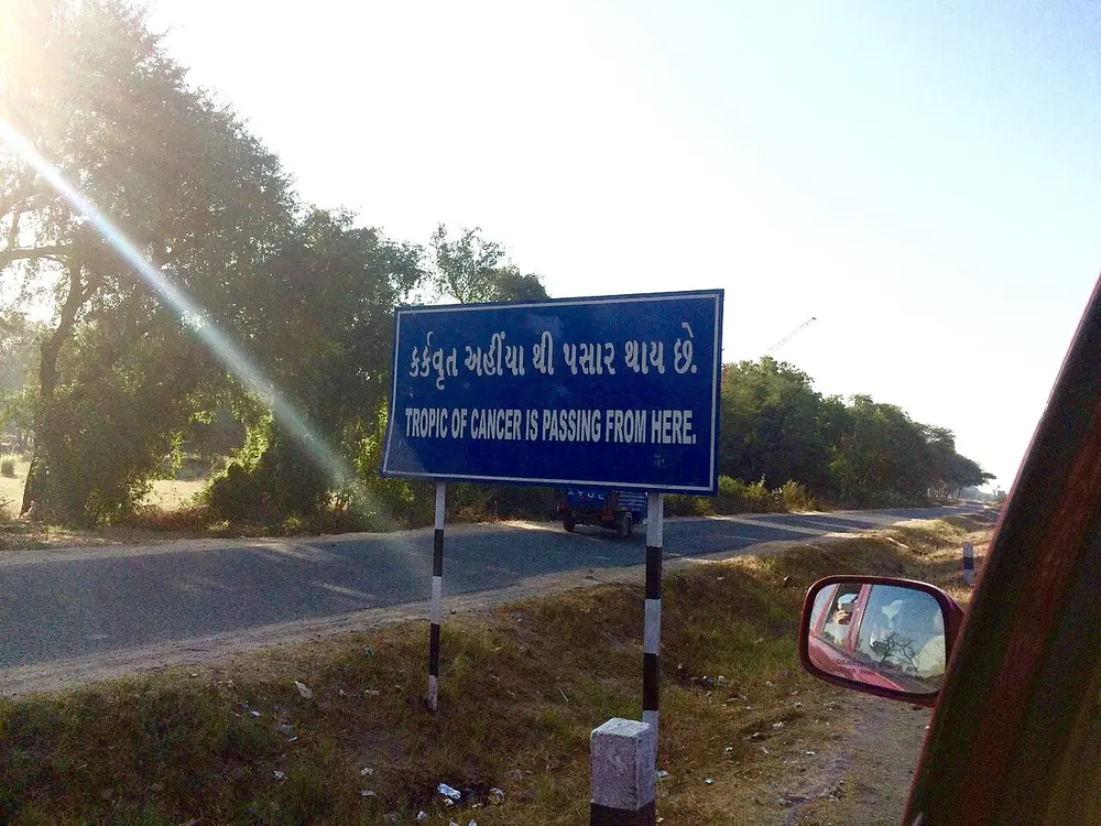
The Tropic of Cancer is the line of latitude where the sun is straight overhead at noon on the longest day of the year. It runs across India from west to east through eight states: Gujarat, Rajasthan, Madhya Pradesh, Chhattisgarh, Jharkhand, West Bengal, Tripura and Mizoram. Signs mark where it crosses roads, like this one near Mehsana in Gujarat (pictured).
Remember
West to east, two pairs then four: Gujarat and Rajasthan, Madhya Pradesh and Chhattisgarh, then Jharkhand, West Bengal, Tripura, Mizoram.
Don't confuse
It does not cross Maharashtra, Odisha, Bihar or Uttar Pradesh. Between West Bengal and Tripura it passes through Bangladesh.
Neighbours and borders
India has land borders with seven countries, as given by the Ministry of Home Affairs: 15,106.7 km in all. Sri Lanka and the Maldives are neighbours across the sea. Sri Lanka is separated from India by the Palk Strait and the Gulf of Mannar.
Gujarat, Rajasthan, Punjab, Jammu and Kashmir, Ladakh
Nepal
1,751 km
Uttarakhand, Uttar Pradesh, Bihar, West Bengal, Sikkim
Myanmar
1,643 km
Arunachal Pradesh, Nagaland, Manipur, Mizoram
Bhutan
699 km
Sikkim, West Bengal, Assam, Arunachal Pradesh
Afghanistan
106 km
Ladakh
These are India's official figures, which follow India's official map. Two of them include land India claims but does not hold. The 106 km border with Afghanistan runs along Gilgit-Baltistan, which India shows as part of Ladakh but Pakistan has held since 1947. Part of the China border runs around Aksai Chin, which India shows as part of Ladakh but China holds. In practice, India and China are separated there by the Line of Actual Control, and India and Pakistan in Jammu and Kashmir by the Line of Control.
West Bengal has the longest border with Bangladesh. Arunachal Pradesh, in the far north-east, borders Bhutan, China (Tibet) and Myanmar; its Upper Subansiri district touches Tibet in the north.
Coastline. India's coastline, including its islands, was re-measured on more detailed maps, and the new official figure, adopted in 2025, is 11,098.81 km, up from the old figure of 7,516.6 km. The coast did not grow: the new maps simply follow more of its bends. Gujarat has the longest coastline of any state, 2,340.62 km on the new measure, and was also the longest on the old one.
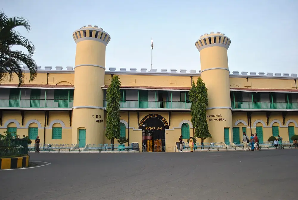
A chain of 836 islands and islets, of which only 31 are lived on. The Ten Degree Channel separates the Andaman group in the north from the Nicobar group in the south. Barren Island is India's only active volcano, and Indira Point on Great Nicobar is India's southernmost point. The capital, renamed Sri Vijaya Puram from Port Blair in September 2024, has the Cellular Jail (pictured), where the British held freedom fighters.
Remember
The Andamans are in the Bay of Bengal, far closer to Myanmar than to mainland India.
Arabian Sea, off the coast of Keralam; capital Kavaratti
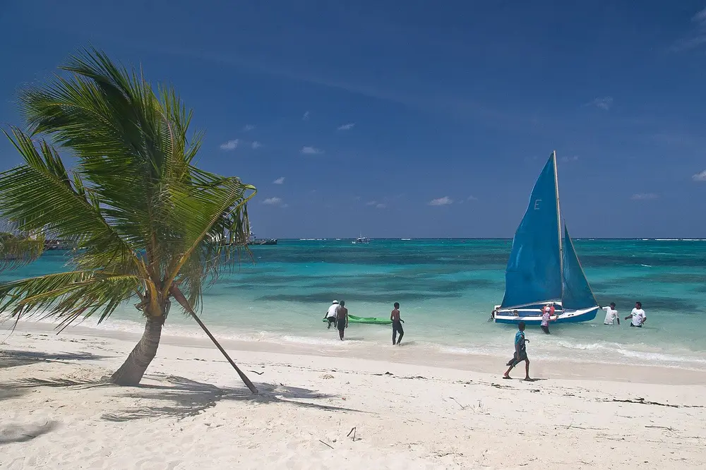
Thirty-six small islands built of coral, with a total land area of only 32 sq km, which makes Lakshadweep the smallest union territory. Its name means "a hundred thousand islands". Clear lagoons ring the islands, like this one at Kavaratti (pictured). The Nine Degree Channel separates Minicoy, the southern island, from the rest.
Remember
Lakshadweep is coral islands in the Arabian Sea; the Andamans are hilly islands in the Bay of Bengal.
Time and India's farthest points
The standard meridian. India stretches nearly 30 degrees of longitude from west to east, so the sun rises in Arunachal Pradesh about two hours before it rises in Gujarat. To give the whole country one clock, India uses a single line of longitude, 82.5 degrees east (82 degrees 30 minutes), which passes near Mirzapur in Uttar Pradesh. Indian Standard Time is 5 hours 30 minutes ahead of Greenwich Mean Time. The line was chosen because it lies near the middle of the country and is a multiple of 7.5 degrees, as time zones usually are.
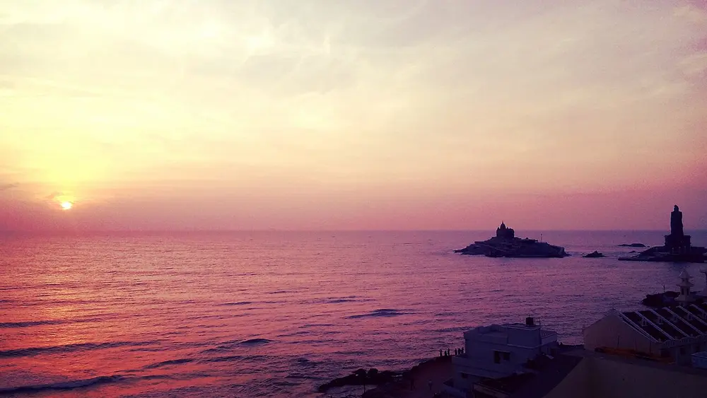
The southernmost point of mainland India, where the Arabian Sea, the Bay of Bengal and the Indian Ocean meet. Just offshore are the Vivekananda Rock Memorial and the tall statue of the poet Thiruvalluvar (pictured). India's true southernmost point is farther south, at Indira Point in the Nicobar Islands.
Remember
Kanyakumari is the tip of the mainland; Indira Point is the tip of India.
Direction
Farthest point
Where
North, on India's official map
About 37 degrees 6 minutes north
Gilgit-Baltistan, Ladakh; held by Pakistan
North, in the area India governs
Near Indira Col, at the Siachen Glacier
Ladakh
South
Indira Point, about 6 degrees 45 minutes north
Great Nicobar, Andaman and Nicobar Islands
South of the mainland
Kanyakumari, about 8 degrees 4 minutes north
Tamil Nadu
East
Near Kibithu, about 97 degrees 25 minutes east
Anjaw district, Arunachal Pradesh
West
Ghuar Mota, near Sir Creek, about 68 degrees 7 minutes east
Kutch district, Gujarat
From north to south India measures about 3,214 km, and from east to west about 2,933 km.
Test yourself
Question 1 of 8
Signs like this one mark the Tropic of Cancer. Which of these states is not crossed by the Tropic of Cancer?
Question 2 of 8
This palace is in the capital of India's largest state by area. Which state is that?
Question 3 of 8
Which became India's 25th state, in 1987?
Question 4 of 8
With which country does India share its longest land border?
Question 5 of 8
This building stands in a city that is the capital of two states. Which two?
Question 6 of 8
As of October 2026, what is the capital of Andhra Pradesh?
Question 7 of 8
Which of these pictures is from India's smallest union territory?
Question 8 of 8
Which of these statements about the areas of states is true?
From past papers
Real exam questions on this topic, each with a full solution.
Mark it as studied to track your progress through the course.
Was this note useful?
Each picture is credited underneath it. Pictures of works still in copyright are shown small, for teaching only. If you hold the rights to a picture and want it removed, tell us through the contact page and we will take it down.