Skip to content

Chapter 9: India and the world on a map

Mountains, plateaus and deserts of India

The Himalaya and its three ranges, the hills of the peninsula, the Deccan and other plateaus, the Thar and the cold desert of Ladakh, with the peaks and passes exams ask about.

In one minute

6 facts to know

  1. The Himalaya is three ranges side by side: Himadri (the highest, north), Himachal (the middle) and Shiwalik (the lowest, south).
  2. The Aravalli are the oldest fold mountains in India; their highest point is Guru Shikhar at Mount Abu.
  3. Anamudi (2,695 m) in Keralam (Kerala until 2026) is the highest peak in south India; Doddabetta (2,637 m) is the highest in the Nilgiris.
  4. Kangchenjunga (8,586 m) on the Sikkim and Nepal border is the highest peak in the area India governs; K2 (8,611 m) is the highest on India's official map.
  5. The Narmada flows between the Vindhya to its north and the Satpura to its south.
  6. India has a hot desert (the Thar), a salt desert (the Rann of Kutch) and a cold desert (Ladakh).

The Himalaya: three ranges in a row

The Himalaya is not one wall of mountains. Going from north to south, it is three ranges side by side, each lower than the one behind it. The word "Himalaya" means "home of snow".

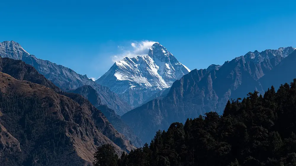
A sharp snow-covered peak rising above dark forested ridges under a clear blue sky.
Picture: Harshit SR. CC BY-SA 4.0.

Himadri

Also called The Great Himalaya, the Inner Himalaya

Where
The northernmost range, from Ladakh to Arunachal Pradesh

The highest and most continuous of the three ranges, with an average height of about 6,000 m. Its peaks are under snow all year, and its glaciers, such as the Gangotri, feed the great rivers of the north. It holds the giants: Kangchenjunga in Sikkim and Nanda Devi in Uttarakhand (pictured), with Everest across the border in Nepal.

Spot it by

Bare rock and permanent snow, far above the tree line.

Remember

Himadri means "snow mountain": the highest range stays white all year.
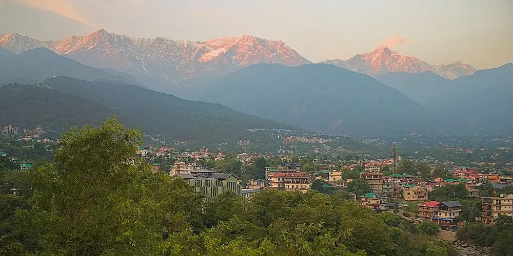
A row of snowy mountains glowing pink in the evening light, above a green hillside town.
Picture: UnpetitproleX. CC BY-SA 4.0.

Himachal

Also called The Lesser Himalaya, the Middle Himalaya

Where
South of Himadri

The middle range, mostly between 3,700 m and 4,500 m high. Its best-known ranges are the Pir Panjal and the Dhauladhar (pictured, above Dharamshala). Most Himalayan hill stations sit here, such as Shimla, Mussoorie and Nainital, along with wide valleys like Kashmir, Kangra and Kullu.

Spot it by

Snow on the high ridges, forest and towns on the lower slopes.

Remember

Himachal is where the hill stations are.
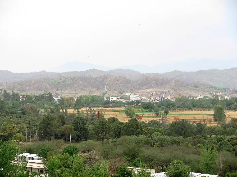
Low, dry, rugged hills on the horizon beyond green fields and trees.
Picture: Zenit. CC BY-SA 3.0.

Shiwalik

Also called The Outer Himalaya, the Sivalik hills

Where
The southernmost range, along the edge of the northern plains

The lowest and youngest range, about 900 m to 1,100 m high (pictured from Chandigarh). It is made of loose gravel, sand and clay that rivers carried down from the higher ranges, so it erodes easily. Between the Shiwalik and Himachal lie long, flat valleys called duns, the best known being Dehradun.

Spot it by

Low brown hills just behind the plains, with no snow.

Remember

The Shiwalik is the first range you see coming from the plains; Dehradun sits behind it.
Range Also called Height Famous for
Himadri Great Himalaya About 6,000 m on average Snow all year; Kangchenjunga, Nanda Devi
Himachal Lesser Himalaya 3,700 m to 4,500 m Hill stations; Pir Panjal and Dhauladhar ranges
Shiwalik Outer Himalaya 900 m to 1,100 m Loose rock; duns such as Dehradun

North-west and north-east

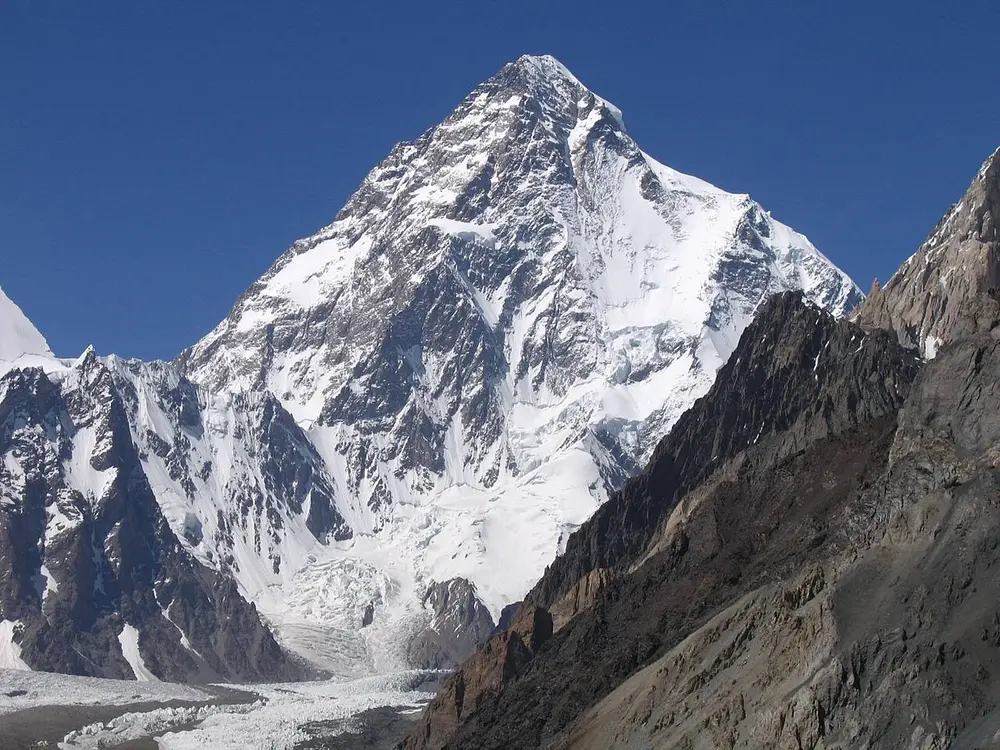
A huge pyramid-shaped snowy mountain above a glacier, with dark rock ridges in front.
Picture: Svy123. CC BY 3.0.

Karakoram

Where
North of the Great Himalaya, in the far north of India's official map

A separate range north of the Himalaya, with some of the highest peaks on Earth. Its highest is K2 (pictured), also called Godwin-Austen, at 8,611 m the second-highest mountain in the world after Everest. K2 stands in Gilgit-Baltistan, which India's official map shows as part of the Union Territory of Ladakh, but which has been held by Pakistan since 1947. The Siachen Glacier, held by India, lies in the eastern Karakoram.

Remember

K2 is in the Karakoram, not the Himalaya. The K is for Karakoram.

Don't confuse

Exams ask for the "highest peak in India". On India's official map it is K2; in the area India governs it is Kangchenjunga. See the peaks table below.
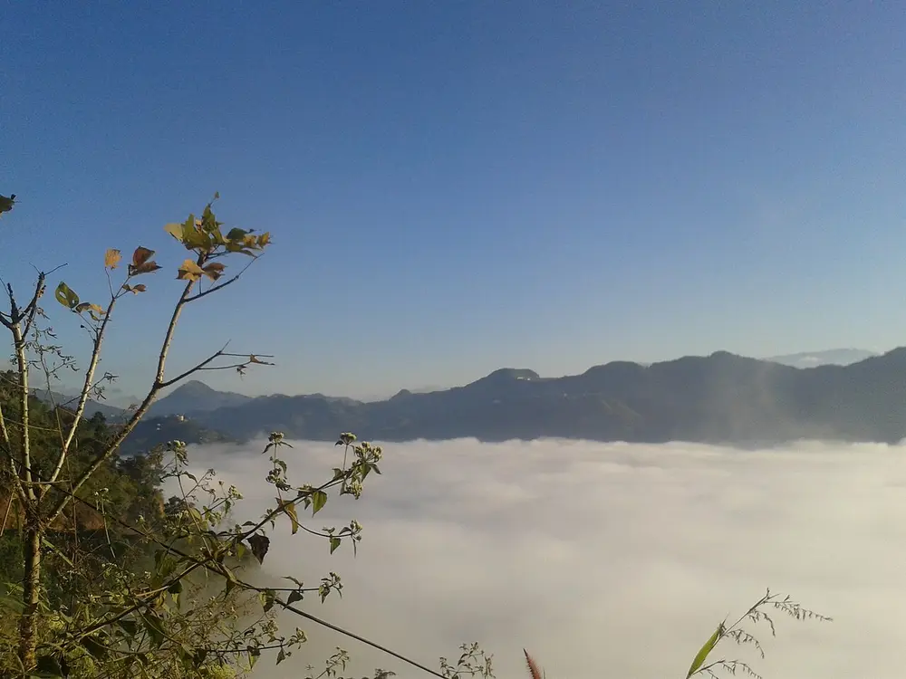
Forested hills rising above a sea of white cloud filling the valley below.
Picture: Vikas Talwar. CC BY-SA 4.0.

Purvanchal

Also called The eastern hills

Where
Along India's eastern border with Myanmar

Past Arunachal Pradesh the Himalaya bends sharply south, and these lower hills run north to south along the Myanmar border. From north to south they are the Patkai hills, the Naga hills, the Manipur hills and the Mizo hills (pictured), also called the Lushai hills. They are made mostly of sandstone and covered in thick forest.

Remember

Purva means east: the Purvanchal are the eastern hills.

The hills of the peninsula

South of the northern plains is the peninsula, a much older block of land. Its hills are lower than the Himalaya because they have been worn down for far longer.

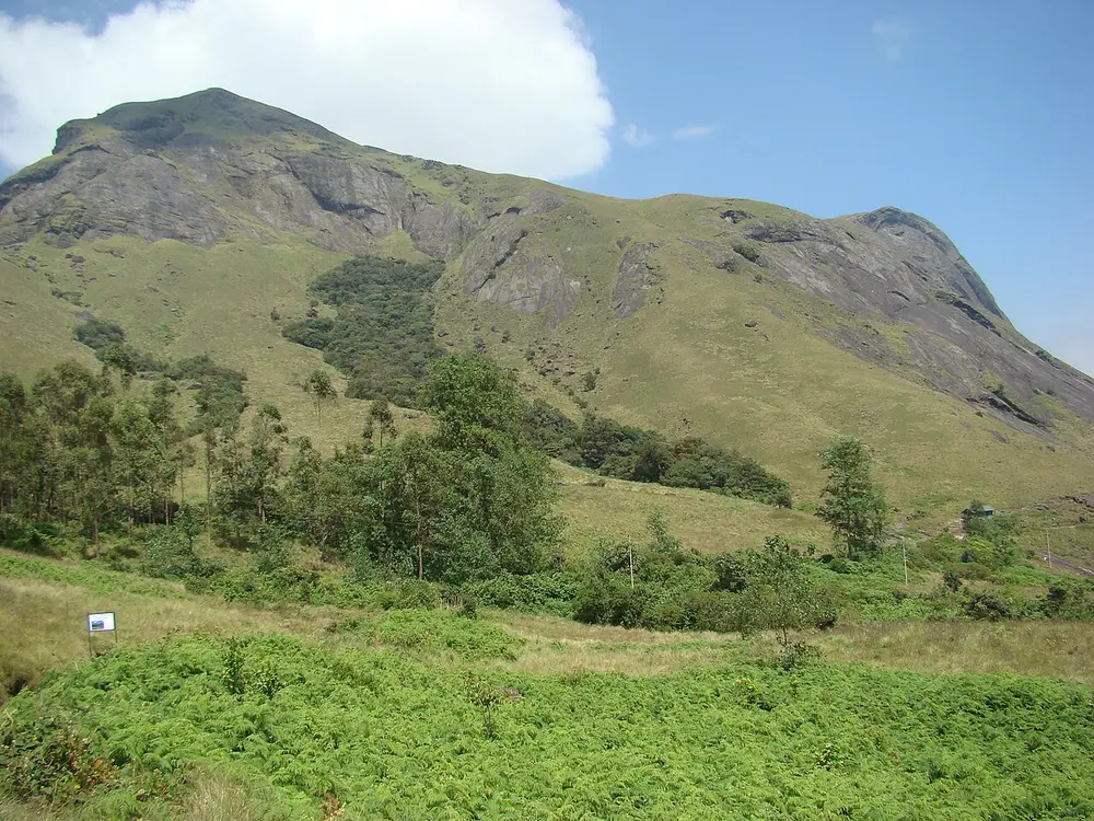
A green grassy mountain with a rocky summit under a blue sky, with shrubs in the foreground.
Picture: Jiths. CC BY 2.0.

Western Ghats

Also called Sahyadri

Where
Along the west coast, from Gujarat and Maharashtra to the tip of Tamil Nadu

An almost unbroken wall of hills about 1,600 km long, getting higher towards the south. In Maharashtra it is called the Sahyadri. It stops the monsoon winds, so its western side gets very heavy rain, and most of the big peninsular rivers, including the Godavari, Krishna and Kaveri, rise here and flow east. Its highest peak is Anamudi (pictured), 2,695 m, in the Anaimalai hills of Keralam. The range is a World Heritage Site.

Spot it by

Steep, green, rain-soaked slopes facing the Arabian Sea.

Remember

Anamudi means "elephant's head", and it is the head of south India: the highest peak.

Don't confuse

Doddabetta (2,637 m) near Ooty is the highest peak of the Nilgiri hills, where the Western and Eastern Ghats meet. It is lower than Anamudi.
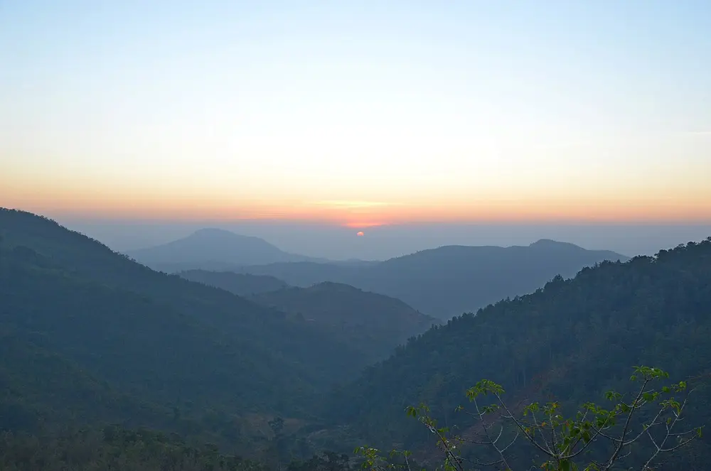
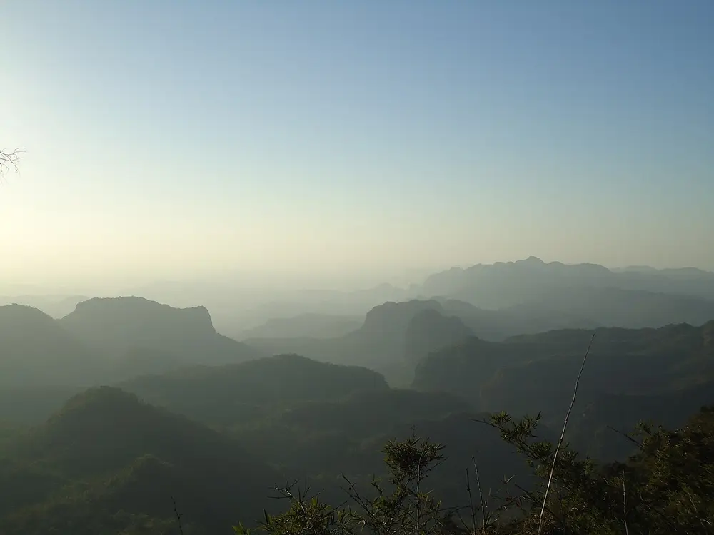
Layers of forested hills fading into haze under an orange sunrise.
Picture: Drashokk. CC BY-SA 4.0.

Eastern Ghats

Where
Along the east coast, from Odisha through Andhra Pradesh to Tamil Nadu

Lower than the Western Ghats, with an average height of about 600 m, and broken into separate groups of hills. They are broken because the big east-flowing rivers, the Mahanadi, Godavari, Krishna and Kaveri, have cut through them on their way to the Bay of Bengal. Groups include the Nallamala, Javadi and Mahendragiri hills.

Remember

West is a wall, east is broken.
A long, low, rounded ridge covered in scrub, with small green fields at its foot.
Picture: Onef9day. CC BY 3.0.

Aravalli

Where
From Delhi through Haryana and Rajasthan to near Ahmedabad in Gujarat

The oldest fold mountains in India, formed well over a billion years ago and worn down into low, rounded ridges (pictured near Alwar). They run about 670 km from south-west to north-east, and the Delhi Ridge is their tail end. The highest point is Guru Shikhar, 1,722 m, at Mount Abu in Rajasthan. The Thar Desert lies to their north-west.

Spot it by

Low, rocky, scrubby ridges rather than tall peaks.

Remember

The oldest mountains are the most worn down: the Aravalli are low because they are so old.
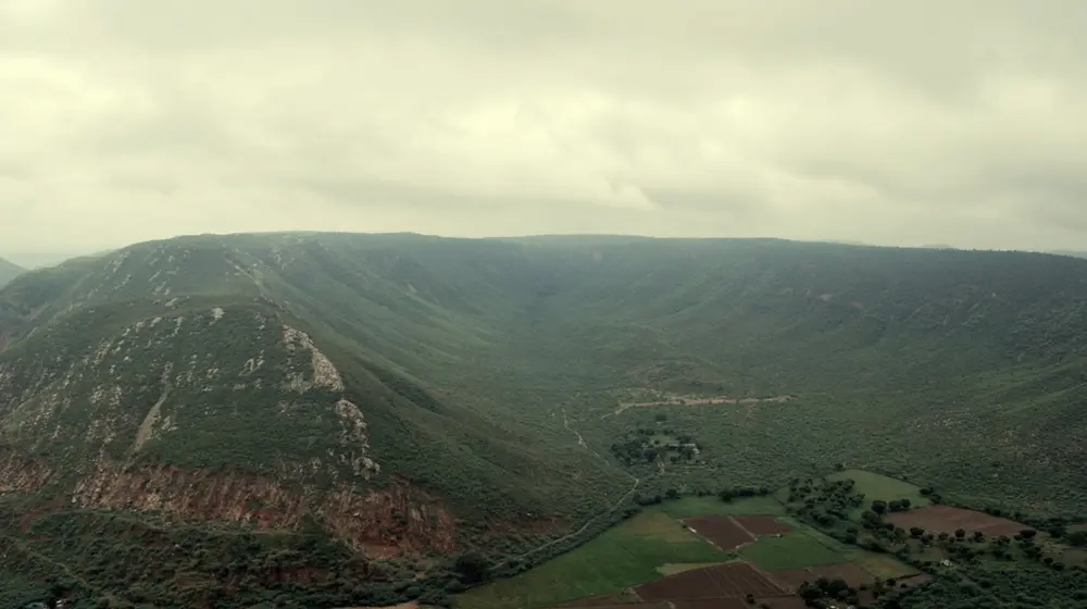
Flat-topped hills and deep valleys in morning haze, seen from above.
Picture: Yashjaiswal12. CC BY-SA 4.0.

Vindhya and Satpura

Where
Central India, mainly Madhya Pradesh

Two ranges of hills that run east to west across the middle of India. The Vindhya lie north of the Narmada river and the Satpura lie south of it, so the Narmada flows west in the long valley between them. They have long been seen as the line between north and south India. The highest point of the Satpura is Dhupgarh, about 1,350 m, at Pachmarhi (pictured).

Remember

Going south: Vindhya, then the Narmada, then Satpura, then the Tapi.

Peaks to know

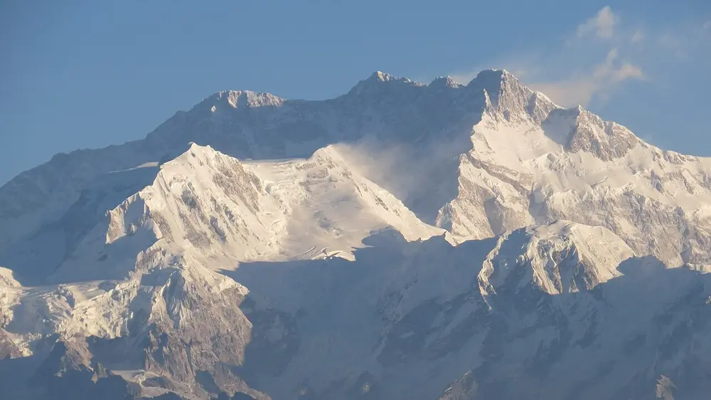
A massive snow-covered mountain wall with several summits, under a pale blue sky.
Picture: ShivaShankara. CC BY-SA 4.0.

Kangchenjunga

Also called Khangchendzonga

Where
On the border of Sikkim and Nepal
When
8,586 m high

The third-highest mountain in the world and the highest peak in the area India governs. It is sacred to the people of Sikkim. The Khangchendzonga National Park around it became India's first "mixed" World Heritage Site, listed for both nature and culture, in 2016.

Spot it by

A broad wall of snow with several summits, seen from Darjeeling, Gangtok and Pelling (pictured).

Remember

Third in the world, first in India-governed land.
Peak Height Where Why it matters
K2 (Godwin-Austen) 8,611 m Karakoram, Gilgit-Baltistan Highest on India's official map; held by Pakistan
Kangchenjunga 8,586 m Sikkim and Nepal border Highest in the area India governs
Nanda Devi 7,816 m Uttarakhand Highest peak lying wholly inside India
Anamudi 2,695 m Anaimalai hills, Keralam Highest in south India and the Western Ghats
Doddabetta 2,637 m Nilgiri hills, Tamil Nadu Highest in the Nilgiris
Guru Shikhar 1,722 m Mount Abu, Rajasthan Highest in the Aravalli
Dhupgarh About 1,350 m Pachmarhi, Madhya Pradesh Highest in the Satpura

Mount Everest (8,849 m), the highest mountain in the world, is on the border of Nepal and China, not in India.

Plateaus

A plateau is high, mostly flat land, raised above the land around it. North of the Himalaya lies the Tibetan Plateau, the highest plateau in the world. India's own plateaus are in the peninsula.

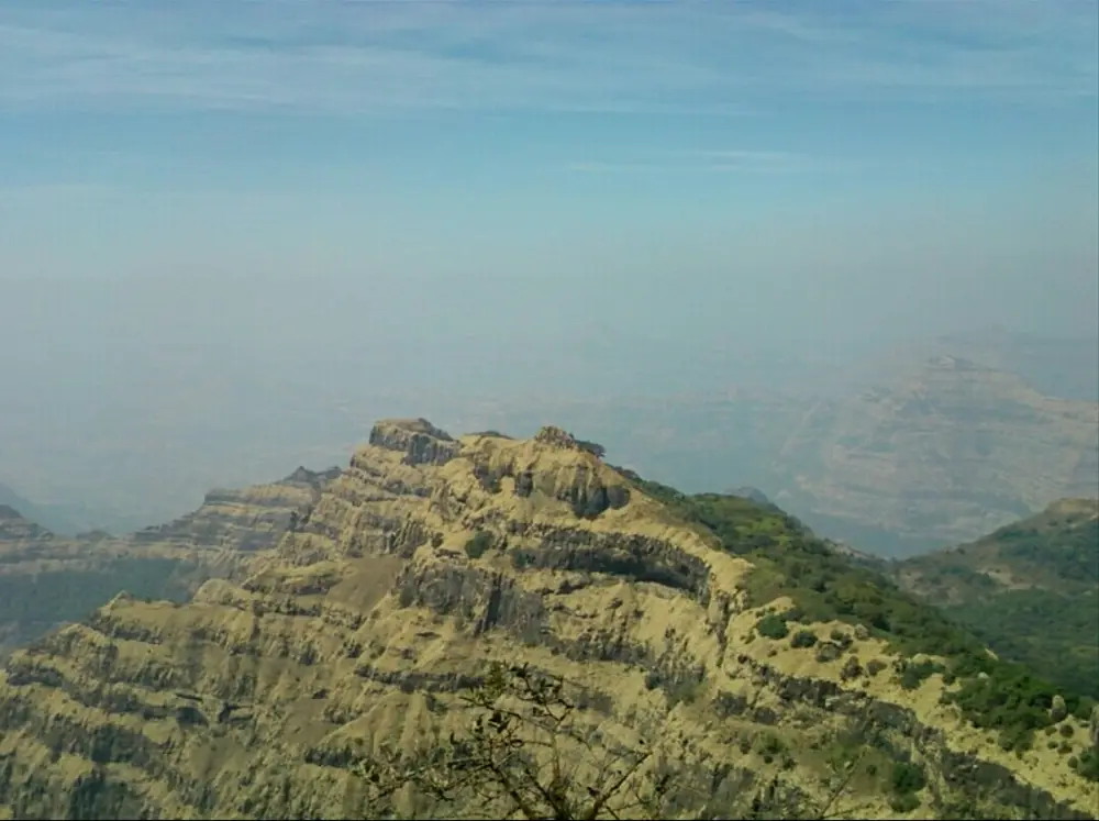
A steep hillside made of horizontal rock layers, like giant steps, fading into haze.
Picture: Appy91. CC BY-SA 4.0.

Deccan Plateau

Where
Most of peninsular India, south of the Satpura

A huge triangle of high land, with the Western Ghats on its west, the Eastern Ghats on its east, and the Satpura and nearby hills on its north. It tilts gently towards the east, which is why most of its rivers flow east. Its north-western part is the Deccan Traps: layer upon layer of basalt rock left by huge lava flows about 66 million years ago (pictured near Mahabaleshwar). This rock weathers into black soil, which is good for growing cotton.

Spot it by

Flat-topped hills built of step-like rock layers.

Remember

Deccan comes from dakshin, meaning south.
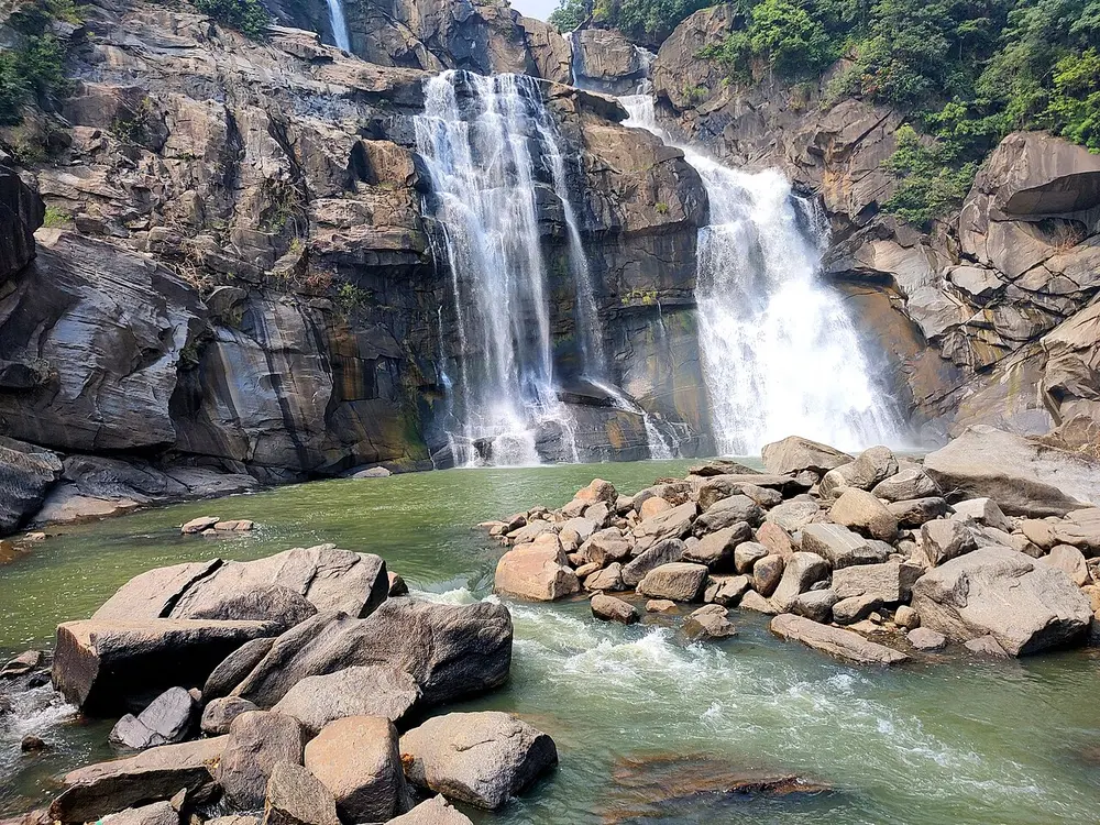
A waterfall pouring in several streams over dark layered rock into a green pool full of boulders.
Picture: Kingshuk Mondal. CC BY 4.0.

Chota Nagpur Plateau

Where
Most of Jharkhand, with parts of Chhattisgarh, Odisha, West Bengal and Bihar

India's storehouse of minerals, with large deposits of coal, iron ore, mica and bauxite. That is why the steel towns of Jamshedpur and Bokaro and the coalfields around Dhanbad grew up here. Rivers drop off the edges of the plateau in waterfalls, such as Hundru Falls near Ranchi (pictured).

Remember

Chota Nagpur is the mineral heartland.
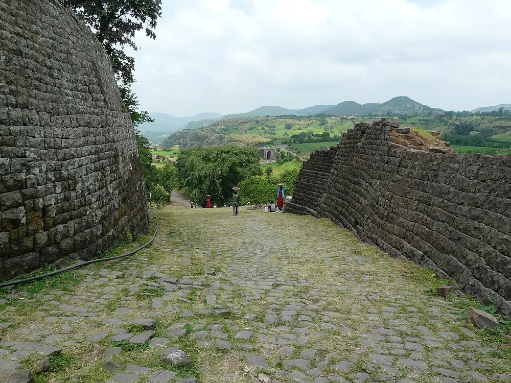
An old stone gateway and walls on a plateau edge, with green hills in the distance.
Picture: Varun Shiv Kapur. CC BY 2.0.

Malwa Plateau

Where
Western Madhya Pradesh and south-eastern Rajasthan

A plateau of old volcanic rock with fertile black soil, lying between the Aravalli to the north-west and the Vindhya to the south. The Chambal river rises here, near Mhow, and flows north to join the Yamuna. Its main cities are Indore and Ujjain. The fort town of Mandu sits on its southern edge (pictured), looking across to the Vindhya hills.

Remember

Malwa sits on top of the Vindhya.

Deserts

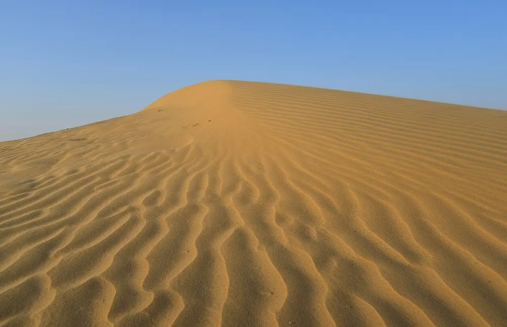
A smooth orange sand dune with wind ripples across its slope, under a blue sky.
Picture: Clément Bardot. CC BY-SA 4.0.

Thar Desert

Also called The Great Indian Desert, Marusthali

Where
North-west of the Aravalli, mostly in Rajasthan, and across the border into Pakistan

India's hot, sandy desert, with less than 150 mm of rain a year in its driest parts. The wind piles the sand into long ridges and crescent-shaped dunes called barchans (pictured). The Luni is its only large river. Jaisalmer, Bikaner and Barmer are desert towns, and the Indira Gandhi Canal brings river water into it.

Spot it by

Rippled sand dunes, camels and very little green.

Remember

The Aravalli are the wall; the Thar is on the dry side of it.
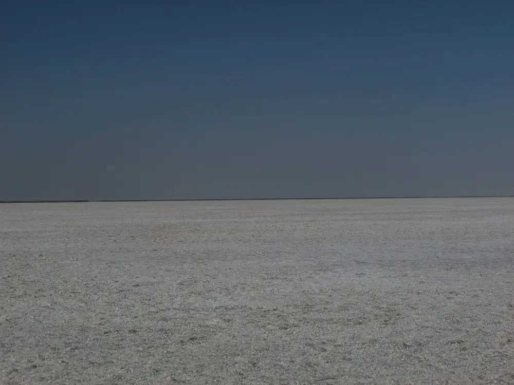
A flat white salt plain stretching to the horizon under a pale sky.
Picture: Ranjith Kumar Inbasekaran. CC BY-SA 4.0.

Rann of Kutch

Also called The White Rann

Where
Kutch district, Gujarat, with a small part in Pakistan

A huge salt marsh rather than a sandy desert. In the monsoon it floods with seawater and rain; in the dry season the water evaporates and leaves a hard white crust of salt (pictured). It has two parts, the Great Rann and the Little Rann. The Rann Utsav festival is held on the white salt at Dhordo each winter, and the Little Rann is a sanctuary for the Indian wild ass.

Spot it by

Flat white salt as far as the eye can see.

Remember

Rann means salt marsh. White Rann, white salt.
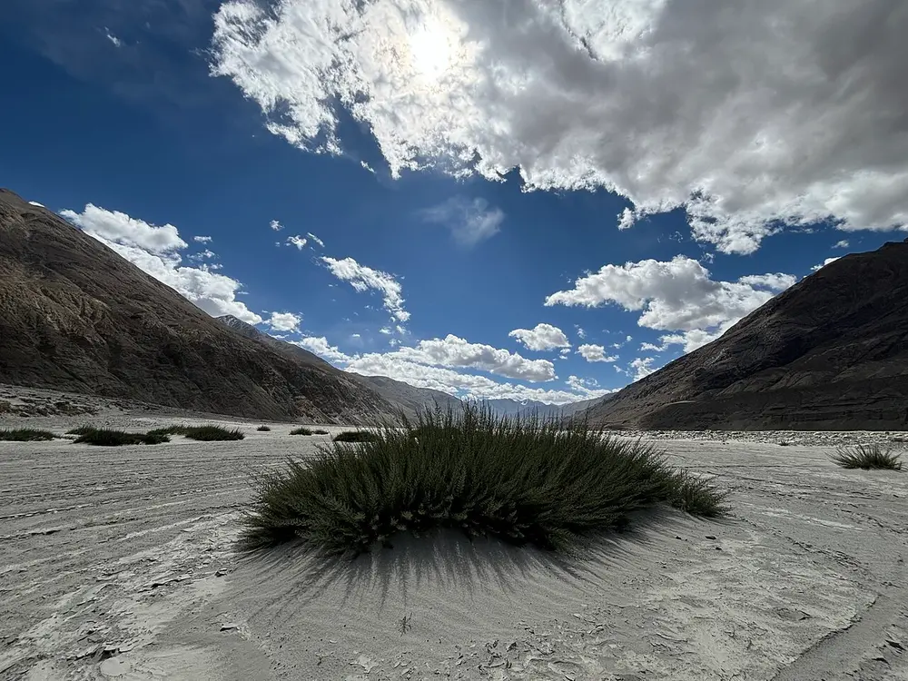
A wide grey sandy valley floor with a clump of grass, between bare brown mountains under clouds.
Picture: HiranmoyPAC. CC BY-SA 4.0.

Ladakh cold desert

Where
Ladakh, and the Spiti valley in Himachal Pradesh

A desert that is cold instead of hot. Ladakh is very high (Leh is about 3,500 m above sea level) and lies behind the Great Himalaya, which blocks the monsoon clouds, so it gets very little rain or snow. Summers are dry and winters bitterly cold. The Nubra valley (pictured) even has sand dunes, where two-humped Bactrian camels live.

Spot it by

Bare brown mountains, grey sand and almost no trees.

Remember

Deserts are dry, not always hot: Ladakh is dry because the Himalaya blocks the rain.
Desert Type Where
Thar Hot, sandy Rajasthan, into Pakistan
Rann of Kutch Salt marsh Kutch district, Gujarat
Ladakh Cold, high Ladakh; also Spiti in Himachal Pradesh

Passes

A pass is a low gap in a mountain range that people use to cross it. "La" means pass in Tibetan and Ladakhi, so Khardung La is simply "the Khardung pass".

Pass Where What it connects
Khardung La Ladakh, about 5,359 m Leh with the Nubra and Shyok valleys; one of the highest motorable roads in the world
Zoji La Between Jammu and Kashmir and Ladakh Srinagar and the Kashmir valley with Kargil and Leh, on National Highway 1; often shut by snow in winter
Nathu La Sikkim, on the India-China border Gangtok with Tibet's Chumbi valley; an old trade route and a route for the Kailash Mansarovar Yatra
Shipki La Kinnaur, Himachal Pradesh, on the India-China border Where the Sutlej river enters India from Tibet; a border trade point
Rohtang Pass Pir Panjal range, Himachal Pradesh, about 3,980 m Manali and the Kullu valley with Lahaul and Spiti
Bara-lacha La Himachal Pradesh, on the Manali to Leh road Lahaul with Ladakh; two headwaters of the Chenab rise near it

Border trade with Tibet through Nathu La, Shipki La and Lipulekh (in Uttarakhand) restarted in August 2026, after a gap of about six years.

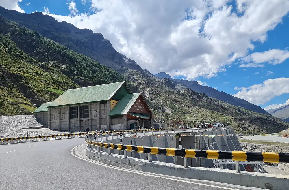
A road curving towards a tunnel entrance building at the foot of steep green mountains, under a blue sky with clouds.

The south end of the Atal Tunnel near Manali. The 9.02 km tunnel runs under the Rohtang Pass. It opened on 3 October 2020, cut the Manali to Leh road by about 46 km, and keeps Lahaul and Spiti connected through the snowy months when the pass is closed.

Picture: Jagseer S Sidhu. CC BY-SA 4.0.

Test yourself

Question 1 of 8

This snow peak is in the highest of the three Himalayan ranges. Which range is that?

Question 2 of 8

Which of these pictures shows the Thar Desert?

Question 3 of 8

This white salt plain is in which state?

Question 4 of 8

Which are the oldest fold mountains in India?

Question 5 of 8

Which is the highest peak in south India?

Question 6 of 8

This tunnel runs under which mountain pass?

Question 7 of 8

Which of these is a mountain pass, not a river?

Question 8 of 8

This mountain is the highest peak in the area India governs. It stands on the border of Sikkim and which country?

From past papers

Real exam questions on this topic, each with a full solution.

Finished this note?

Mark it as studied to track your progress through the course.

Was this note useful?

Each picture is credited underneath it. Pictures of works still in copyright are shown small, for teaching only. If you hold the rights to a picture and want it removed, tell us through the contact page and we will take it down.