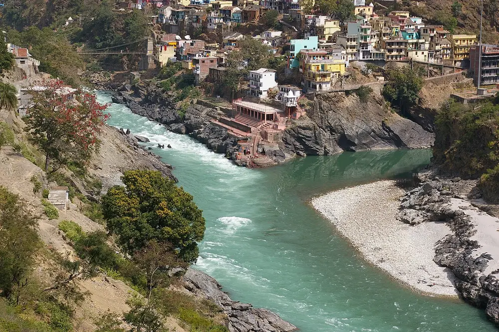
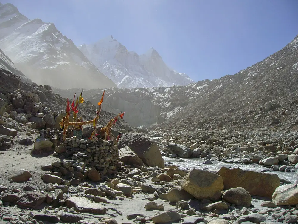
1The Bhagirathi (from Gaumukh) and the Alaknanda meet at Devprayag; from there the river is called the Ganga.
2The Yamuna joins the Ganga at the Triveni Sangam in Prayagraj, where the hidden Saraswati is believed to join them.
3The Brahmaputra is the Tsangpo in Tibet and the Siang in Arunachal Pradesh; Majuli in Assam is its great river island.
4The Godavari is the longest river of the peninsula and is called the Dakshin Ganga.
5Most peninsular rivers flow east to the Bay of Bengal; the Narmada and Tapi flow west, through rift valleys, to the Arabian Sea.
6The Luni of Rajasthan never reaches the sea: it ends in the Rann of Kutch.
Two kinds of river
India's rivers come in two families.
Himalayan rivers (the Indus, Ganga and Brahmaputra and their tributaries) are fed by both rain and melting snow and glaciers, so they flow all year. They carry a lot of silt and wind across the northern plains.
Peninsular rivers (the Godavari, Krishna, Kaveri, Narmada and others) rise in the hills of the peninsula and are fed mainly by the monsoon rain, so many shrink a lot in the dry season. Their valleys are older and their courses more fixed.
A tributary is a river that flows into a bigger one. A confluence, or prayag or sangam, is the place where two rivers meet.
Rises in Tibet near Lake Mansarovar; flows through Ladakh, then Pakistan, to the Arabian Sea
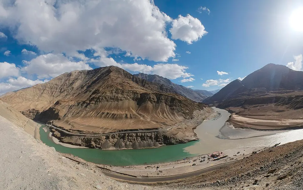
The westernmost of the big Himalayan rivers, about 2,880 km long. In India it flows through Ladakh, where the Zanskar joins it near Nimmu (pictured). It gave India its name: the Greeks heard Sindhu as "Indos". Its five big eastern tributaries are the Jhelum, Chenab, Ravi, Beas and Sutlej, the rivers that give Punjab, "the land of five waters", its name.
Remember
Indus, Sindhu, India: one river, three names.
River
Where it rises
Remember
Jhelum
Verinag spring, Kashmir valley
Flows through Srinagar and Wular Lake
Chenab
Where the Chandra and Bhaga meet at Tandi, Himachal Pradesh
The largest tributary of the Indus
Ravi
Kullu hills near Rohtang Pass, Himachal Pradesh
Flows through the Chamba valley
Beas
Beas Kund near Rohtang Pass
Joins the Sutlej at Harike in Punjab
Sutlej
Rakas Tal near Mansarovar, Tibet
Enters India at Shipki La; feeds the Bhakra Dam
From west to east the five are Jhelum, Chenab, Ravi, Beas, Sutlej. Wular Lake on the Jhelum is usually called India's largest freshwater lake.
Under the Indus Waters Treaty of 1960, India got the use of the three eastern rivers (Ravi, Beas, Sutlej) and Pakistan most of the water of the three western ones (Indus, Jhelum, Chenab). In April 2025 India put the treaty "in abeyance", meaning on hold, and as of October 2026 it remains on hold.
The Ganga is born here, where the Bhagirathi meets the Alaknanda (pictured). It enters the plains at Haridwar and flows across Uttar Pradesh, Bihar and West Bengal to the Bay of Bengal, about 2,525 km in all, the longest river in India. Near the sea it splits: the Hooghly flows past Kolkata, and the Padma flows into Bangladesh, where it joins the Brahmaputra to form the Sundarbans delta. It was declared India's National River in 2008.
Spot it by
Two streams of different colours joining below the town's temple and ghats.
Remember
Dev-prayag, the gods' confluence: the place the Ganga gets its name.
The Alaknanda meets four other rivers on its way to Devprayag. These five meeting points are the Panch Prayag: Vishnuprayag (Dhauliganga), Nandprayag (Nandakini), Karnaprayag (Pindar), Rudraprayag (Mandakini) and Devprayag (Bhagirathi).
Rises at the Yamunotri Glacier, Uttarakhand; joins the Ganga at Prayagraj
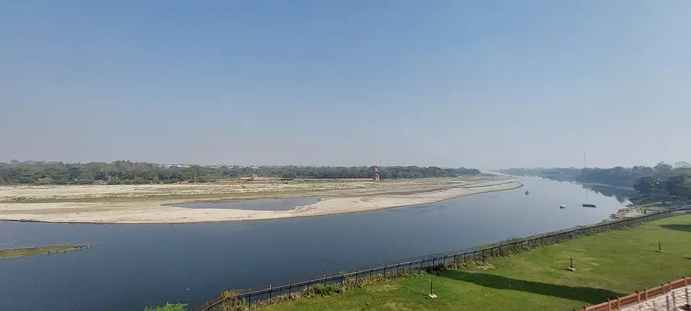
The longest tributary of the Ganga and the one farthest west. It flows past Delhi, Mathura and Agra, where it runs beside the Taj Mahal (pictured, from the Taj). The Chambal, Betwa and Ken flow into it from the south, from the plateau of central India.
Remember
Delhi, Mathura and Agra are all on the Yamuna, not the Ganga.
Don't confuse
Yamunotri is the source of the Yamuna; Gangotri is the source of the Bhagirathi. Both are in Uttarakhand.
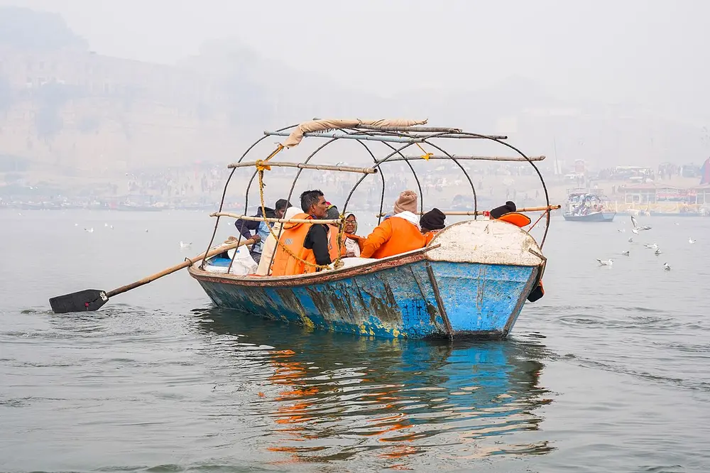
The meeting point of the Ganga and the Yamuna. Hindu tradition holds that a third river, the unseen Saraswati, joins them here, which is why it is called the meeting of three (triveni). It is the site of the Kumbh Mela, the largest gathering of people on Earth; the last Maha Kumbh was held here in 2025.
Spot it by
Pilgrims in boats out on the water where the two rivers mix.
Remember
Tri means three: Ganga, Yamuna and the hidden Saraswati.
Also called Tsangpo in Tibet, Siang or Dihang in Arunachal Pradesh, Jamuna in Bangladesh
Where
Rises near Mansarovar in Tibet; flows through Arunachal Pradesh and Assam into Bangladesh
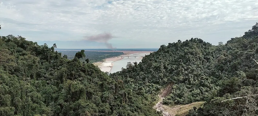
One of the largest rivers in the world, and a river of many names. It flows east across Tibet as the Tsangpo, swings round the end of the Himalaya and enters India in Arunachal Pradesh as the Siang (pictured near Pasighat, where it reaches the plains). Joined by the Dibang and Lohit, it becomes the Brahmaputra and flows west through Assam past Guwahati. It is known for its floods and for constantly shifting its channels.
In the Brahmaputra, Assam, reached by ferry from Jorhat
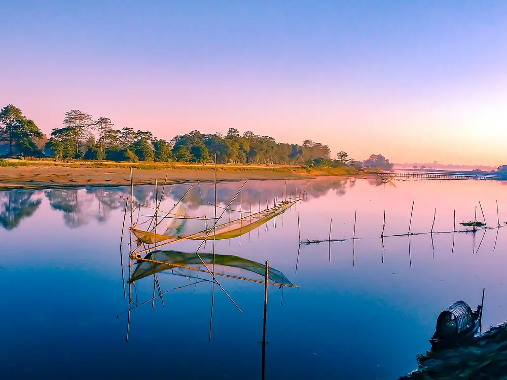
A huge island in the Brahmaputra, often called the largest river island in the world. In 2016 it became India's first district that is an island. It is the centre of the Vaishnava monasteries called satras, famous for their masks and dance-dramas. The river is slowly eating away its banks, so the island has shrunk over the years.
Spot it by
Flat land, wide water and bamboo fishing nets (pictured).
Remember
Majuli: India's first island district, in the Brahmaputra.
Rises at Trimbakeshwar near Nashik, Maharashtra; flows east to the Bay of Bengal in Andhra Pradesh
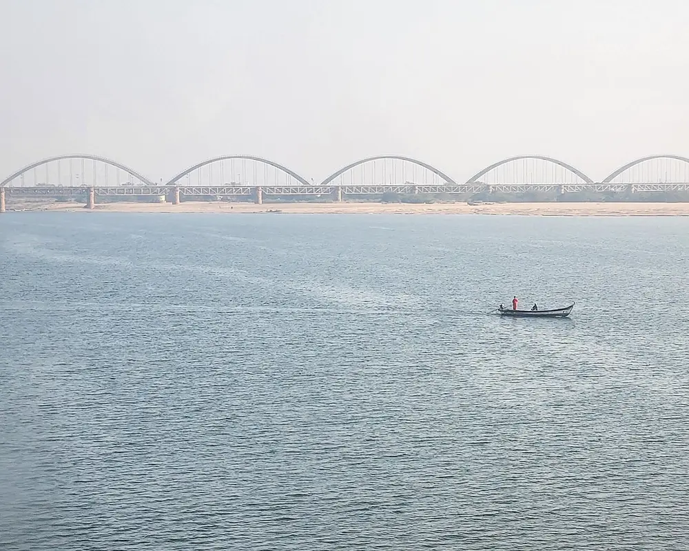
The longest river of the peninsula, about 1,465 km, with the largest basin. Its size and holiness earned it the name Dakshin Ganga. It flows across Maharashtra, Telangana and Andhra Pradesh, widening into a great river at Rajahmundry (pictured), before splitting into a delta.
Remember
The biggest river of the south is "the Ganga of the south".
Rises at Talakaveri in the Brahmagiri hills, Kodagu, Karnataka; flows east through Tamil Nadu to the Bay of Bengal
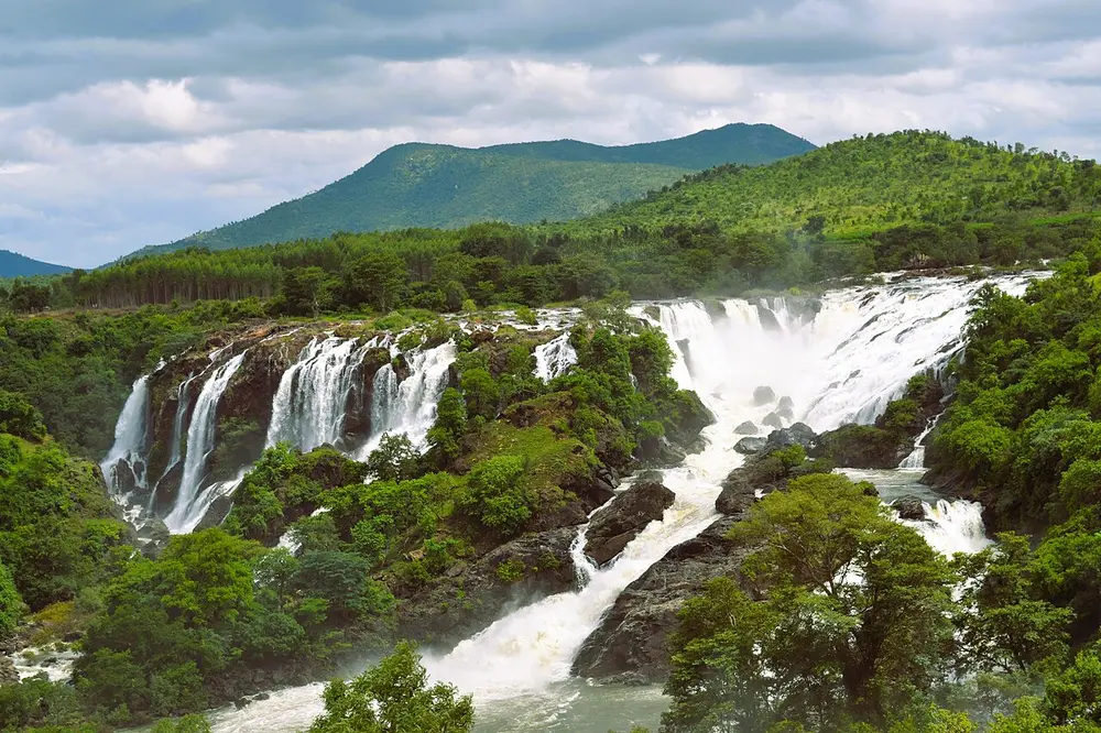
About 800 km long. Its upper basin gets the south-west monsoon in summer and its lower basin the north-east monsoon in winter, so it flows more steadily through the year than most peninsular rivers. It tumbles over the Shivanasamudra Falls in Karnataka (pictured) and forms river islands at Srirangapatna and Srirangam.
Remember
The Kaveri gets two monsoons.
Between the Godavari and the Kaveri lies the Krishna, which rises near Mahabaleshwar in Maharashtra and flows east through Karnataka, Telangana and Andhra Pradesh, past Vijayawada. Its main tributaries are the Koyna, Bhima and Tungabhadra. In the east, the Mahanadi rises near Sihawa in Chhattisgarh and flows through Odisha to the Bay of Bengal.
Rises at Amarkantak, Madhya Pradesh; flows west to the Arabian Sea in Gujarat
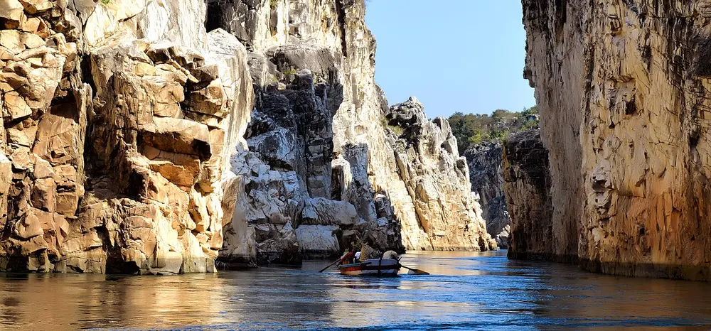
The largest river that flows west. It runs through a rift valley, a long trough where the land sank between two faults, with the Vindhya to its north and the Satpura to its south. Near Jabalpur it cuts a gorge through the Marble Rocks at Bhedaghat (pictured) and drops over the Dhuandhar Falls. In Gujarat it is held back by the Sardar Sarovar Dam, and the Statue of Unity stands on its bank facing the dam.
Remember
West-flowing rivers are rift-valley rivers: the Narmada, and the shorter Tapi to its south.
River
Rises at
Flows into
Godavari
Trimbakeshwar, Nashik, Maharashtra
Bay of Bengal
Krishna
Near Mahabaleshwar, Maharashtra
Bay of Bengal
Kaveri
Talakaveri, Kodagu, Karnataka
Bay of Bengal
Mahanadi
Near Sihawa, Chhattisgarh
Bay of Bengal
Narmada
Amarkantak, Madhya Pradesh
Arabian Sea, through the Gulf of Khambhat
Tapi
Multai, Betul, Madhya Pradesh
Arabian Sea, near Surat
Mahi
Madhya Pradesh, in the Vindhya
Gulf of Khambhat; crosses the Tropic of Cancer twice
Sabarmati
Aravalli hills, Udaipur district, Rajasthan
Gulf of Khambhat, after flowing past Ahmedabad
Luni
Near Pushkar, Ajmer, Rajasthan
The Rann of Kutch; it never reaches the sea
Son
Amarkantak, Madhya Pradesh
The Ganga, near Patna
Where rivers rise
Gaumukh, "the cow's mouth", the snout of the Gangotri Glacier in Uttarakhand, where the Bhagirathi begins.
Amarkantak is the one to remember: two rivers rise there and go opposite ways. The Narmada flows west to the Arabian Sea, and the Son flows north to the Ganga.
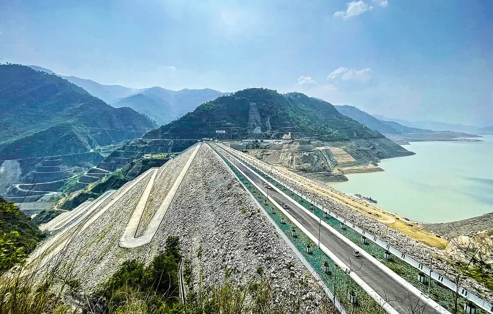
At 260.5 m, the tallest dam in India. It is built of rock and earth rather than concrete, and holds a long reservoir that supplies water to Delhi and western Uttar Pradesh and makes hydroelectric power. The old town of Tehri was drowned under its lake, and a new town was built above it.
On the Sutlej, Bilaspur district, Himachal Pradesh
When
Completed 1963
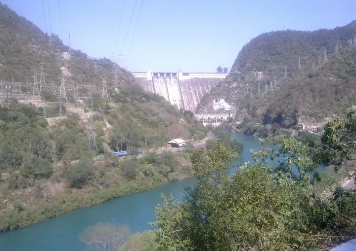
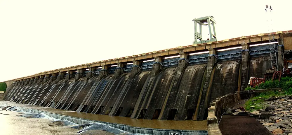
A 226 m concrete dam in a gorge of the Sutlej, one of the first great projects of independent India. Its reservoir is called the Gobind Sagar. With the Nangal Dam downstream in Punjab, it is often called Bhakra-Nangal, and its canals water the farms of Punjab, Haryana and Rajasthan.
Remember
Bhakra on the Sutlej; its lake is the Gobind Sagar.
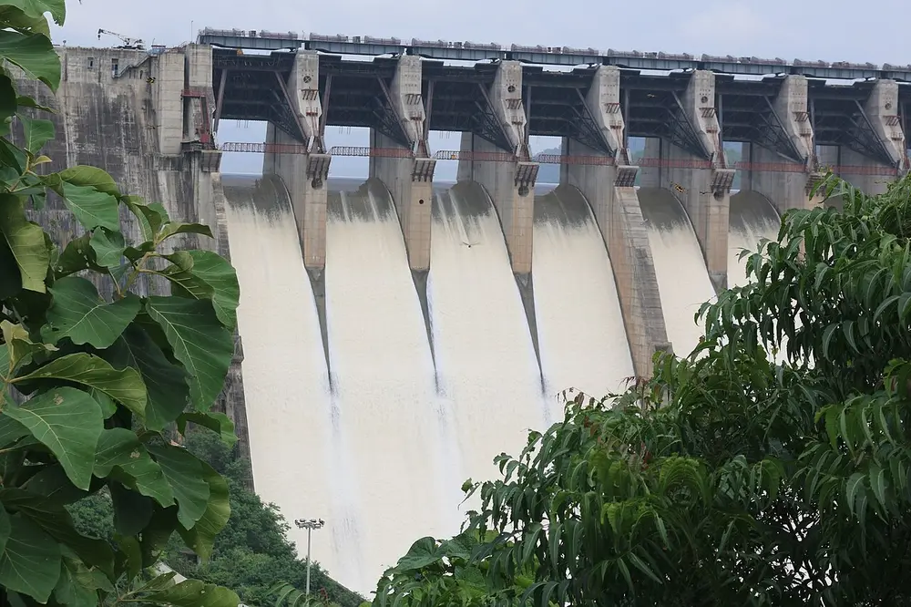
Usually called the longest earthen dam in the world, counting its long earth walls (dykes) on either side of the concrete section. It was built to stop the floods that used to hit the Mahanadi delta, and to water farms and make electricity. Its reservoir stretches about 55 km.
On the Narmada, near Kevadia, Narmada district, Gujarat
When
Foundation stone 1961; finished 2017
The biggest dam on the Narmada, carrying water by canal across Gujarat and into Rajasthan. Its reservoir drowned many villages, and the Narmada Bachao Andolan protested for decades for the people who lost their homes. The 182 m Statue of Unity, of Sardar Vallabhbhai Patel, stands nearby facing the dam.
Remember
Sardar Sarovar and the Statue of Unity are both named after Sardar Patel, and both stand on the Narmada.
On the Sharavathi river, Shivamogga district, Karnataka
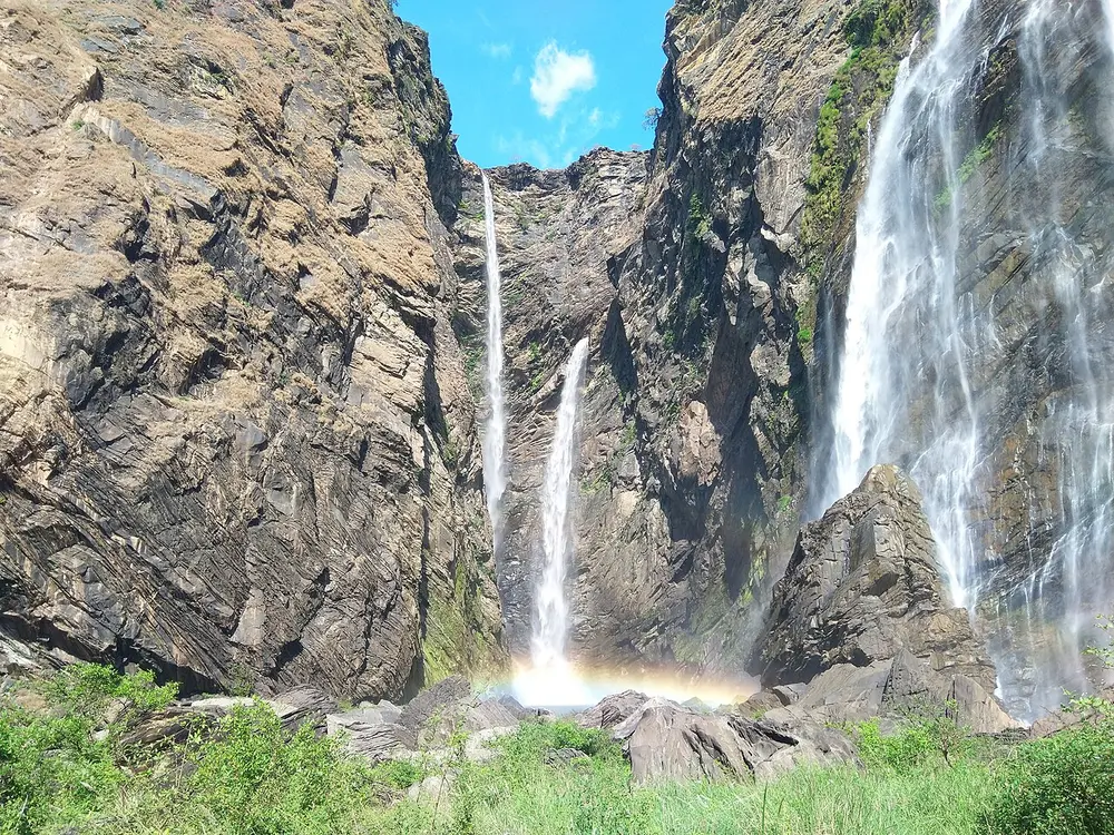
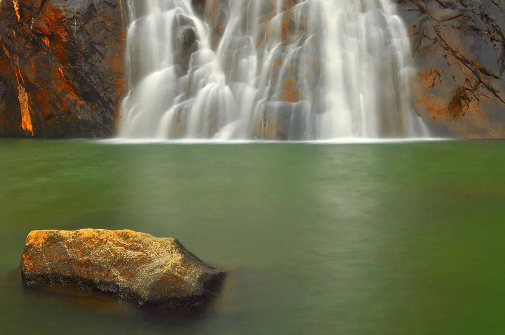
The Sharavathi drops about 253 m in one leap here, splitting into four falls named Raja, Rani, Roarer and Rocket. It is one of the highest plunge waterfalls in India, and at its fullest just after the monsoon.
On the Chalakudy river, Thrissur district, Keralam (Kerala until 2026)
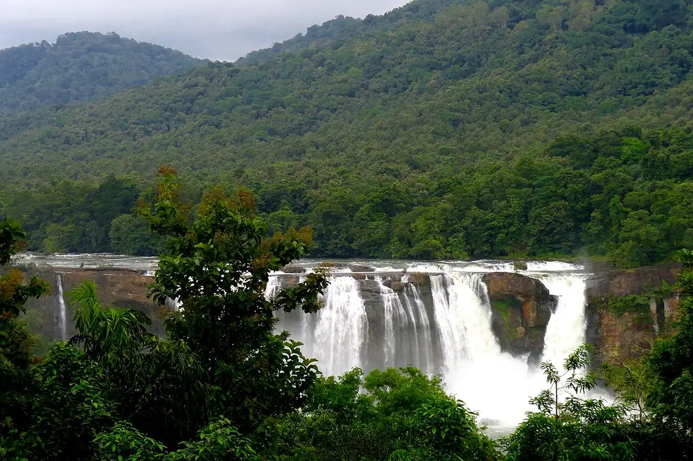
Keralam's largest waterfall, about 25 m high but very wide, set in the forests of the Western Ghats. It is nicknamed the Niagara of India for its broad curtain of water.
Remember
Not the tallest, the widest: the Niagara of India.
On the Mandovi (Mahadayi) river, Goa, on the border with Karnataka
A four-tiered fall about 310 m high, among the tallest in India. Its name means "sea of milk", from the white foam of the water. A railway line crosses the face of the falls on a stone bridge, so trains pass right in front of it.
Remember
Dudh means milk: Dudhsagar is the sea of milk, in Goa.
Waterfall
River
State
Jog
Sharavathi
Karnataka
Shivanasamudra
Kaveri
Karnataka
Athirappilly
Chalakudy
Keralam
Dudhsagar
Mandovi (Mahadayi)
Goa
Dhuandhar
Narmada
Madhya Pradesh
Hundru
Subarnarekha
Jharkhand
Test yourself
Question 1 of 8
Two rivers meet here to become the Ganga. Which two?
Question 2 of 8
Which river is called the Dakshin Ganga?
Question 3 of 8
The Statue of Unity stands on the bank of which river?
Question 4 of 8
Which of these shows the Narmada cutting through a rift valley gorge near Jabalpur?
Question 5 of 8
This island in the Brahmaputra became India's first island district. What is it called?
Question 6 of 8
Which river ends in the Rann of Kutch instead of the sea?
Question 7 of 8
India's tallest dam is built on which river?
Question 8 of 8
Which of these is the Jog Falls?
From past papers
Real exam questions on this topic, each with a full solution.
Mark it as studied to track your progress through the course.
Was this note useful?
Each picture is credited underneath it. Pictures of works still in copyright are shown small, for teaching only. If you hold the rights to a picture and want it removed, tell us through the contact page and we will take it down.